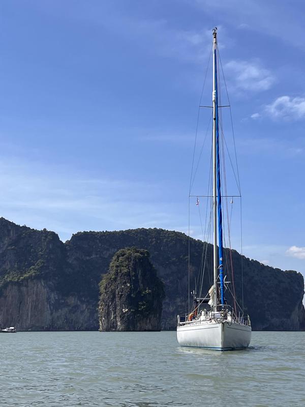
 |
| A very wet crew, en route up the Dardanelles |
Having
waited for the wind to abate, to allow us to make the passage up the
Dardanelles without fighting current and strong winds, it duly did;
only to be replaced by periods of torrential rain! The passage up the
Dardanelles was made hugging the southern shore as tightly as we
could to keep out of the worst of the current, which reached 4+ kts
at some of the headlands, thus reducing our speed over ground to 1.5
kts. A crawl! We had departed in the early morning in the hope of
escaping the Straits in the one day however the rain and grey skies
sapped our resolve and we finally put into the harbour at Lapseki to
seek shelter from the rain by retiring below and to pass the night.
This was the same refuge I had used four years earlier but in the
intervening period the depths in the harbour had reduced through
silting and we were forced to anchor relatively near the entrance for
fear of going aground a second time this season; as it was we
encountered 2.1m, only 0.1 metres more than our draft!
 |
| Entrance to Lapseki |
The night
in Lapseki was tranquil and the morning bright. The only thing
lacking was wind! Having motored all the previous day (beating up the
Dardanelles, against the foul current, in the pouring rain, for some
reason held no attraction!) we were keen to get under sail again but
it was not to be. We motored out into the Sea of Marmara in a flat
calm, and so it was for the rest of the day. Our aim was to reach the
Pasalimani Islands and seek an anchorage there, and after 7.5 hours
and 41 miles covered we anchored off the SW coast of Avsa Adasi, only
to discover that the bay we had chosen was too deep close in to allow
us the necessary swinging room, hence we upped anchor again and moved
round to the SE side of the island where we found a delightful
anchorage off Kumburnu Limani.
 |
| Dawn mist at Avsa Adasi |
After a
peaceful night and an early morning swim we sailed off the anchor and
headed into the sound at Pasalimani. The western entrance is now
marked by port and stbd hand buoys as well as an Isolated danger mark
on the small group of rocks just inside the entrance. With the wind
dying away yet again we finally motored the last mile or so into an
anchorage on the western side of the sound, adjacent to Koyun Adasi.
With no wind and little else to do we passed a pleasant afternoon
relaxing in the bay, swimming and sunbathing. As evening approached
we motored across the bay and went stern to on the northern side of
the redundant ferry pier. Although close in, and with less than 3m
depth, it was safe enough to allow us to proceed ashore for dinner in
the only restaurant in the village, sitting out on their boat pier,
watching the sun set, over the water. The meal, salad and grilled
fish, was simple but good and very inexpensive even including two
bottles of very passable local wine (the proprietor seemed not to
possess a corkscrew, the corks were pushed into the bottle – he
obviously does not sell much wine!). On our return to the boat we
discovered that the breeze had shifted direction, bringing one of the
local boats, on a very slack mooring, too close for comfort. For this
reason we pulled off the jetty at midnight and anchored a short way
out, opposite the Jandarma (Military Police) station. Safe for
tonight then!
 |
| Kurukulla on the redundant ferry pier at Pasalimani |
Next
morning we dropped Christoph back on the jetty to procure some fresh
bread and attempt to get a gas bottle filled. Sadly neither was
possible, the baker had not yet started baking and the gas (hardware)
shop did not have the necessary fittings to fill European Gaz
bottles. Having retrieved him from the jetty we set off north to a
bay at the north-eastern end of the sound for a relaxing lunch and to
await some wind. By 1500 there was a slight breeze and so we set off
for the south coast of Pasalimani via the channel to the east that
separates it from the Kapidag Peninsula. By 1900 we were anchored in
a bay, at the bottom of a delightful green valley, near the SE corner
of Pasalimani. Another quiet night!
With less
than 48 hours to go to Melvin's departure we decided that it would be
wise to plan for him to leave from Erdek and take a taxi to Bandirma,
only 5 miles away by land but on the other side of the isthmus that
connects the Kapidag Peninsula to the mainland, hence 35 miles by
sea! For this reason we spent the following day sailing in the waters
between Pasalimani and Erdek but going nowhere in particular, ending
up anchored in the NW corner of the bay, at Ocaklar, 4 miles away
from Erdek town. From here it was an easy hop next morning, in the
flat calm, to motor into Erdek.
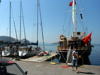 |
| Alongside the "Aqua nightclub", Erdek |
The town quay at Erdek is mostly
occupied by small local boats and hulks used as floating
bar/restaurants. We were fortunate to be able to squeeze in between a
local yacht and the small jetty, on the opposite side of which was
the latest floating bar, “Aqua”, being prepared for its opening.
The refit was in full swing but they broke off to take our lines and
were very happy for us to connect into their electricity supply as
well. Their plan was to open two days later but there was still much
to be done! After lunch ashore Melvin departed in his taxi and
Christoph and I set off to procure victuals from the local shops;
that done we settled for an evening in Erdek and decided on a
relatively early departure the following morning.
 |
| Sunset looking from Koyun Adasi towards Avsa Adasi |
In the
event it was 1000 when we let go our lines and set off for an
anchorage on the W side of Koyun Adasi, a deserted bay that I had
sighted on my previous visit in 2011 but had not had time to
research. By 1830 that evening, after a day of drifting at 1 – 2
knots, we were anchored in the intended bay and enjoying a G&T or
two, supper and a spectacular sunset; all in that order. In the event
it was a delightful anchorage, that is if you can ignore the ever
present jelly fish that are in the Sea of Marmara in their millions;
they are wherever you look.
 |
| Ever present jelly fish! |
Eventually you get used to brushing
against them as you swim but the sensation takes some getting used
to! Uggh! On a more positive note there also seem to be many more
dolphins this year, in both the Aegean Sea and Sea of Marmara; hardly
a day has gone past, since leaving Marmaris, without at least one
sighting of a pod and frequently there have been several sightings in
a day.
 |
| Becalmed in the Pasalimani Islands |
Our plan
was to leave next morning, as soon as there was any wind, and this we
did at 1130, ghosting out of the bay on a very light westerly breeze,
it lasted all of 15 minutes! Between 1200 and 1600 we covered all of
400m! A slight southerly current (0.2 kts) offset any gains we made
in moving north! Eventually we gave in and started the engine and
motored east, along the north coast of the Kapidag Peninsula
looking for a suitable bay for the night. We settled upon a small but
delightful bay just 800m east of Turan. We had it to ourselves, that
is if you don't count the very few vehicles negotiating the unmade
road halfway up the surrounding escarpments.
 |
| Kurukulla anchored in a small bay just W of Ormanli Burnu |
This bay
was paradise but sadly the beach was saturated with plastic rubbish.
It is hard to believe that in the 50 years since mass produced
plastic was invented we have managed to fill so many of the world
beaches with plastic refuse! It cannot go on like this! At least
glass sinks and eventually returns to sand when carelessly abandoned
on a beach!
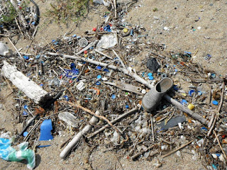 |
| The never ending plastic debris |
Next day
we had a relaxing day of sun and swimming, enjoying the tranquillity,
before setting out eastwards again at 1600. As our luck would have it
the cooling onshore breeze that we had enjoyed all day, instead of
getting stronger as the afternoon went on, faded away leaving us no
option but to motor again along the coast heading for either
Cakilkoy, a fishing harbour at the eastern end of the Kapidag
Peninsula, or the islands just off the end of the headland known as
the Mola Adalari. As we approached the islands clouds developed very
quickly and for the last quarter mile we suddenly had winds of 25 kts
but only for 15 minutes, but the time we had anchored in a bay on the
leeward side of the largest of the islands we were back to a flat
calm! Exactly the same as the weather we awoke to next morning!
At 0900
we weighed anchor and ghosted away from the island setting course to
the east, close hauled on port tack, intending to cover a least half
of the distance to Istanbul. By 1030 we had had to resort to motor
sailing as the wind, what there was, had chosen to back round to the
W and hence we were now going downwind in 3 – 4 knots of true wind,
hardly quick progress, and we had 35 miles to go! I got worse! By
1400 we had had to roll up the genoa, haul the mainsail in to the
centreline and we were motoring along in a flat calm. Eerie! Only in
the last two hours of a eight hour passage, did a gentle breeze
appear from the NNW, allowing us to dispense with the engine for the
final stages into Armutlu where we anchored off the rather touristy
beach; an anchorage tenable in northerly winds or a calm; and where
we settled down for a relaxing, if less than tranquil, evening.
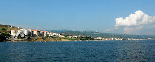 |
| Armutlu waterfront and static windmills |
On
the hillside behind the beach were numerous static monuments to
Turkeys race to generate power from the wind, I hope the populous,
living in the functional but rather characterless blocks of flats
fronting the beach, remember to switch off their air conditioning on
stifling but windless days like today!
The next
day was a fairly gentle passage starting with ghosting around the
headland at Boz Burun and then eastwards along the south shore of the
Sea of Marmara towards Yelova Marina where we planned to spend the
first few days of the sojourn in and around Istanbul.
 |
| Yalova marina |
Yelova is a
relatively new marina and probably the cheapest available with good
ferry links to the city. There are direct and inexpensive ferries to
Pendik on the Asian side of Istanbul and Atakoy on the European side.
The marina proved to be a quiet location but with good facilities and
at €50 per night we were not complaining.
After
four days in the marina and doing the tourist trek in Istanbul each
day we were getting itchy feet and so set off for a night at anchor
in the Princes Islands. The anchorage at Cam Limani, on the island of
Heybeliyada, is one of the best sheltered in this part of the Sea of
Marmara and for this reason is popular with visitors and locals alike
but on this occasion, given the rather unseasonal weather, there was
plenty of room. After a brisk close reach across from Yalova,
averaging 7 knots, we anchored in the bay and settled for a quiet
night onboard. This was the penultimate day onboard for Christoph, my
crew for the last 6 weeks, so we settled down to supper onboard and a
bottle or two of wine.
The next
day we sailed off the anchor and headed across to Pendik marina from
where Christoph could easily get a taxi to Istanbul Sabiha airport at
0600 the following morning. All went as planned and I am now back to
being single handed for a few days. Back to the Princes islands
tomorrow!
More on
departure from Istanbul.............
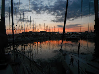 |
| Sunset at Pendik marina |
 |
| Old Istanbul |
 |
| Hagia Sophia |
 |
| Self at Orient Express Restaurant, Istanbul Stn |
 |
| Taksim Square |
 |
| Topkapi Palace entrance |
 |
| Inside the Harem, Topkapi Palace |
 |
| Sultan Ahmet (Blue) Mosque |


