 |
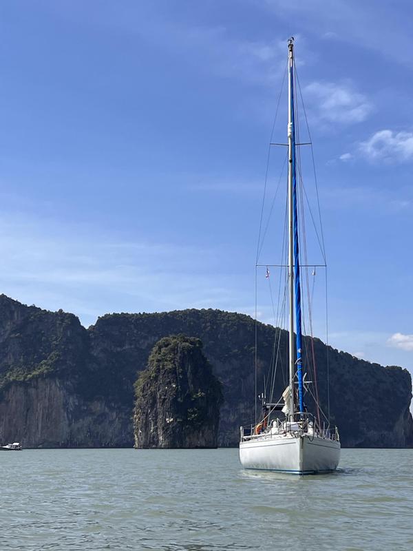
| Departing Port Stephens |
Our next leg of our voyage, from Port Stephens to
Coffs Harbour, started at 0700 and started well. Although a bit lumpy
we had the East Australian current behind us as the whole bay, in
which the entrance to Port Stephens lies, is one big eddy; meaning
that we had the current assisting us despite going north east. That
lasted 27 miles, until Seal Rocks, where we started to have to fight
the current and fight it we did. We went into almost every bay to get
out of the current and then had to battle it around each of the
headlands, all in light and fluky winds. At times we had engine revs
for 7kts run
g on and were doing 2.4kts over the ground; not conducive
to a quick passage!
It also meant that, being so close inshore, we could hear the surf breaking on the beaches at night; I was “watch on stop on” as navigator. No sleep when you are that close in! I can manage 36 hours without sleep but I wouldn't want to do it for much more without a break somewhere.
As I mentioned above the favourable but light winds that had been promised did not materialise. It was verging on flat calm from Seal Rocks to Coffs Harbour.
Not great as, given the favourable forecast and the absence of an obvious fuel source, we had not bothered to seek out fuel at Port Stephens. This meant that with the significant extra distance due to the current and the absence of any wind until the last few hours, it was going to be touch and go whether we reached Coffs Harbour before nightfall. After rounding Smoky Cape in the early light of Monday morning, 35 miles from Coffs Harbour, we tucked ourselves tight into the coast and picked up another eddy; this carried us northwards at 1.5kts and thus we opted to drift for a few hours and wait for the onshore breeze to set in, which it fortunately did at midday.
 |
| Pollution on the approach to Coffs Harbour |
The only problem here was that we discovered to our horror that the eddy we were seeking had also acted as a collection point for an oil slick! It looked as though some anonymous tanker had illegally discharged his ballast water offshore and we were now drifting through it. Fortunately we managed to avoid the worst of it but it went on, in one form or another, for over 15 miles.
By 1530 we were off Coffs Harbour where we stowed the sails before motoring in towards the harbour entrance. Coffs Harbour entrance faces directly east and is open to the prevailing surf so it was an exhilarating ride through the entrance, reminiscent of some of the Moroccan ports facing the Atlantic. Fortunately Kurukulla rides the waves well and we surfed through the entrance into the harbour and somewhat to our surprise picked up a second wave inside the harbour! It was all designed to add excitement to an otherwise dull passage. Later in the day I was speaking to a power boat owner who had come in just before us and he told me he came in at 17kts to avoid being overtaken by the waves!
On entry to the marina we went straight to the refuelling jetty an topped Kurukulla up. 114ltrs with a fuel capacity of 140ltrs so we were low but not out! I have only once run her dry and that was many years ago when trying to make a flight connection for a departing friend who was onboard; I'm glad to say he made his flight! After refuelling it was a move into the allocated berth, a celebratory G&T and then bed for 12 hours!
 |
| Coffs Harbour from the masthead |
As you can imagine the next day was spent quietly on a walk along the coast and a spot of rest and recreation but a yachtsman's work is never done. The following day was a maintenance day with the top priority being sorting out the wind-speed sensor at the top of the mast, it had stopped working en route to Coffs Harbour. Much to Yiorgos' dismay he had to winch me up the mast. I checked the rotation and freed up the impeller which then seemed to work perfectly, as verified by Yiorgos from the instruments on deck; however, within two minutes of me being back on deck, it stopped working again! His displeasure went from bad to worse when he realised that this repeat failure would require two further trips up the mast, the first to bring it down for further investigation and the second to refit it. An awful lot of winching! In addition to this there was a laundry run to do and a few other more minor items to pass the time.
 |
| and it rained! |
After a fish and chip lunch at the fishermen's Co-operative we departed Coffs harbour in the early hours of the afternoon of 14 April. Our plan was to sail direct from here to the Gold Coast marina at the start of the inland waterways leading to Brisbane; 162 miles north of us. The winds were favourable, despite the odd heavy shower, and we made the Gold Coast Seaway entrance in the late afternoon of the following day; we averaged 6 knots despite having to battle the current for the whole passage. This time, with sufficient wind to make good progress, I decided to stay offshore and have a more restful passage; at least for me as the skipper/navigator. Despite several rain showers en route the passage passed uneventfully.
The entry to the Seaway was easy, clearly marked and deep, and our pre booked marina was only 2 miles south of the entrance. We had attempted to book at the Southport Yacht Club marina but unfortunately they had no free berths and advised booking at the Gold Coast marina. This was a mistake; it was very much not our style of marina. It was bulging with “Super Yachts” and very little attention was paid to clients in smaller vessels.
 |
| Entering Gold Coast Seaway |
On arrival we discovered that our allocated berth had no markings to identify it! Fortunately I had taken the precaution of downloading a marina map from the internet but others told us they had just taken the first free berth! The only person on site when we arrived was a security “guard” who finished work at 1800 hence no overnight security. It didn't take us long to decide that his wasn't the marina for us! The following morning we informed the Security Guard that we would be leaving the following day, a day earlier than planned, but this message was obviously not passed on. When I received the bill for our stay it included the day after our departure and a quantity of electricity that we could not have used even if we had been a 'super-yacht'. Eventually some weeks later I received a refund having explained to the management exactly what I thought was wrong with their marina organisation!
After our conversation with the security guard we set off on a walking tour of the Gold Coast resort. From seaward it looked like the CBD of Sydney or Melbourne, that is until you realised that the buildings were not office blocks but all had balconies at every level.
 |
| Gold Coast centre |
Although in the past, in my Naval career, I have travelled a considerable part of the world I have never seen such a density of apartment buildings with virtually none of the facilities needed to support living there. Until we returned to Southport, by tram, we had hardly seen a shop or pub. From Southport township we crossed the river and stopped off for a final evening meal in the Southport Yacht Club before our farewell to the Gold Coast resort. Early the following morning, to catch the rising tide, we set off up the inland waterways to Brisbane.
 |
| On passage through the Broadwater, mangroves. |
Seven hours and 42 miles later we were berthing in the Royal Queensland Yacht Squadron marina having negotiated the shallow channels without incident and enjoyed a pleasant day watching nature go by.
The RQYS was a very welcoming club and we opted to spend two nights there in order to give us time to visit the Brisbane City Centre. The infrastructure investment in Brisbane is astounding. The dedicate underground busways make getting around very easy. Our only hiccough was on arriving to catch the train into the city centre, from Manly suburb where the RQYS is situated, we discovered that the service had been partially suspended and that over half of our journey would be by bus. You can't win them all! It was also amusing to note that the gauge (distance between the rails) of the Queensland railways is different to New South Wales and different again to Victoria.
 |
| Brisbane ANZAC Memorial |
Not good for national cohesion or efficiency! Brisbane city centre was spectacular and although we had, by mistake, chosen a bank holiday to visit we thoroughly enjoyed the day we spent walking around the sights.
Next morning it was a visit to the local Coles to top up on victuals and lunch in the RQYS before setting off northwards again to an anchorage at the northern tip of Moreton Island; the island that forms the lagoon protecting Brisbane. From here we set off at daybreak for the 50 mile passage to Noosa Bay for our next night at anchor, reaching Noosa at 1615 and settling to the anchor well off the beach (the bay is very shallow) but in calm waters. Noosa is very popular with my daughter as a holiday resort but unfortunately time did not allow us the opportunity to step ashore.
 |
| Anchored at Noosa beach |
Next morning at daybreak we were underway again, this time heading for the shallow channel inside Fraser Island, reputedly the biggest sand island in the world. This one was to be even more of a navigational challenge, for some parts we were tide dependent to get through. By 1300 we were surfing over the bar and into the channel separating Fraser Island from the mainland. It was a relatively easy entrance, if a bit daunting when viewed from seaward; it is not immediately obvious where the channel is amongst the continuous line of breakers! Once inside we continued up the channel to the point where further progress was impossible at that state of tide. Here we opted to anchor inside Stewart Island, at Garry's Anchorage, for the night . It was to be a relaxed start the next morning to enable us to catch the rising tide; this was essential to allow us through with the added bonus that if we went aground in the most shallow parts we would refloat on the rising tide. The bottom was all either mud or soft sand!
 |
| North end Stewart Island, where we went aground! |
We watched with envy as the catamarans departed the anchorage heading north, taking advantage of their 1m draft; at 2.1m we were going to have to wait a bit longer for the tide to rise far enough. By 1100 we were set to go; we had two options, retrace our steps by one mile and rejoin the main channel where we had left it or take the narrower, shallower passage northwards past Stewart Island and save ourselves two miles. We opted for the latter but as we passed another monohull, also in the process of leaving, we asked him which option he was going for. He was going south “Too shallow for me up there”. We pressed on regardless! Needless to say we polished the bottom of the keel a couple of times on the way through, where we had to back off and look for a deeper channel, but we got through and were well ahead of the other boat that departed at the same time. It was only when swimming around the boat a week later that I realised how clean the bottom of the keel was …. I was certainly not going to inspect it anywhere near Fraser Island which is renowned for its Crocodile population!
By 1645 we were clear of the shallows and anchored on the NW coast of the island, between the spectacular white coral sand beach and the off-lying sandbank.. Here we stayed until 0800 the next day when we sailed off the anchor, in a brisk breeze, under genoa alone; heading for Bundaberg, the home of Australian Rum.
 |
| Bundaberg river |
By 1600 we were entering the river at Bundaberg and within 30 minutes we were moored at the Bundaberg Port Marina. Conveniently placed at the entrance to the river but, as we later found out, some way from the town.
Our plan was to spend three nights in Bundaberg, with the first day spent as a maintenance day onboard and Monday the 25th touring Bundaberg and re-victualling the yacht. What we had not realised was that there was to be no transport links to the city on either day, Monday 25th of April being ANZAC Day, the commemoration of those members of the Australian and New Zealand Army Corps killed or wounded at Gallipoli in WW1.
 |
| Bundaberg Distillery |
This commemoration, marking the first day of the Gallipoli landings in 1915, is seen as a more important commemoration for the two nations concerned than Armistice day 11th of November. Although the 35,500 ANZAC casualties (dead and wounded) at Gallipoli was markedly less than the UK total of 120,250 it represented a significantly higher proportion of the two nations populations.
As a consequence of the bank holiday we perforce recruited a taxi to take us into town and return us to the marina. Peter, the taxi driver, could not have been more obliging. He gave us a conducted tour on the way in and out, refused payment until after the return journey and was on time to the minute both there and back. Service well above and beyond! Bundaberg itself was very quiet, most shops closed hence we made a walking tour which included a brief tour of the town centre, a walk out to the Botanical Gardens and a late visit to the Bundaberg Distillery. Sadly we had misjudged the Distillery timings, working from Google we had assumed the closing time was the last time of entry for a tour, it was not; closing time was closing time! In the event we arrived just in time for a brief tour of the distillery shop (with some eye watering priced rum on sale) and a final Bundy and coke in the distillery bar. Being the last customers of the day we were offered free drinks if we agreed to close the servery shutter, we accepted of course, without a second thought. Our final event of the day was a trip around Aldi (fortunately open on the bank holiday) to procure all the victuals for the upcoming passage north. With taxi-driver Peter awaiting our exit from the store it was the easiest re-victualling so far! After that it was back to Kurukulla, supper, and an early night before refuelling and an 0700 departure the next day.
Our intention on leaving Bundaberg was to anchor for the following night in Bustard Bay, just west of Roundhill Head, 50 miles north. With the wind in the SE this should have been an ideal anchorage. It was not until we rounded Roundhill Head that we realised that the swell was curling round the headland and sweeping across the bay. It was anything but a comfortable anchorage! After a quick tour of the most promising parts of the bay, looking for any suitable spot to anchor, we decided to make a run for Rodd's Peninsula and the anchorage to the west of it, 20 miles further on. It would be an entry to the shallow estuary in darkness but fortunately it was an easy entrance and we navigated it without a problem. Once in the anchorage it was as tranquil as you could wish. After a welcome night's sleep we awoke the following morning, at 0630, to a vista of a sunlit estuary with us anchored in the midst of nowhere. Surrounded by water and mud banks, not a building in sight!
 |
| Approaching Great Keppel Island |
After a quick getaway we were off again on the 67 mile passage to Great Keppel Island, intending to anchor on the NW side of the island in one or other of the large NW facing bays, both ideal anchorages in SE winds, I thought. The winds on this passage were almost directly behind us as we surfed down the waves maintaining an average of over 7kts. The downside was that the genoa could not make its mind up which gybe it wanted to be on! In the final gybe to enter the bay two more of the batten car links on the mainsail failed simultaneously. These were now the third and fourth to fail on a new, barely used, sail. They are the same design as their predecessors on the old mainsail but since Ronstan has started manufacturing them something has changed. The originals on the old sail lasted over 20 years! Of the new ones some are lasting less than a year; either the material has been changed or the tolerances are now wrong! Whichever they are not fit for purpose and I have informed Ullman who built the sail of the fact, fortunately they are pressing for a solution from Ronstan on my behalf.
 |
| Great Keppel island |
Of the two north west facing bays one would have hoped that either/or would have offered a suitable anchorage in a south east wind. It was not to be. The shallow draft multihulls were all clustered inshore in the easterly bay to escape the swell curling around the headland. The monohulls, too deep draft to get tight in, were left to roll out in the deeper waters of the bay. We chose the westerly bay and tucked ourselves in as far as we could get but it was still going to be a roly night or two. We had been hoping to take a days break from passage making in this anchorage. In fact the following day the swell had subsided enough for us to stick to our plan and we enjoyed a much more stable second night in the same anchorage. Before sunset on day two we were hailed from a passing dinghy, the occupants informed us that they were planning a sundowners gathering on the beach and if we wished we were very welcome to join in. We opted to go but the outboard motor for the dinghy, which hadn't been used for 12 months, had other ideas. It obstinately refused to start and with sunset imminent it was not the time to start ripping it apart! We settled for a glass of wine onboard to toast the sunset, instead!
 |
| Sunset, Pearl Bay |
Next morning we made a dawn departure for the anchorage at Pearl Bay, a delightful anchorage six miles north of Cape Clinton. We entered via the narrow passage from the east rather than circumnavigate the group of small islands that protect the bay. There are miles of deserted sandy beach to choose from, all of which is anchorable at reasonable distance from the shoreline. We shared the bay with one small catamaran and not another soul.
On the basis of onwards, ever upwards, we set off again the following morning to reach the anchorage at South Island, part of the Northumberland Islands group. The weather was not great, grey skies, 25kts of gusty south easterly wind and rain showers frequent enough to ensure you never quite dried out between them. Not classic Australian weather at all. The forecasters were all blaming it on La Ninja persisting longer than expected. Just our luck.
 |
| Refuge Bay, Scawfell Island, Cumberland Islands |
We anchored at the eastern end of Rocky Shelf Bay; an ideal anchorage in the conditions. From here we set off before daybreak, at 0500, determined to make the next anchorage Refuge Bay at Scawfell Island, 68 miles away in the Cumberland Islands, before nightfall. This we did, arriving at 1545 in time to pick up one of the blue free public moorings, with the intention of enjoying a leisurely swim and settling down for the night.
 |
| Not supposed to be like this! |
Unfortunately, as we approached the anchorage I went to roll up the genoa and noticed that the forestay foil looked rather more flexible than usual. After dropping the No1 genoa further investigation showed it had fractured at the entry point to the genoa track. Not good. For now we would have to sail with mainsail alone until we reached a marina/chandlery where repairs could be made. I set about telephoning ahead to try to identify a supplier for a new length of foil and the other necessary spare parts.
 |
| Lindeman Island in the rain |
Next day it was off again for a passage under mainsail alone, north westwards, to Lindeman Island where we anchored off Gap Beach, on the north side of the island; Lindeman Island is part of the group of the same name,. It had been another day of rolling downwind, trying to prevent the mainsail from flogging, dodging the showers when possible and enduring permanently grey skies. The up side was hat I had found a supplier for the new foil section, Quadrant Marine in Coral Coast Marina which is just north of the Whitsunday Islands. They claimed it was the only one in Australia and ordered it on trust; very obliging; especially at $A500+! This was important as we could get there, fit the new section and still be in Hamilton Island, in the Whitsunday's to pick up my daughter, Vanessa, and friend who were joining us for a four day long weekend.
 |
| Both ends of the rainbow! |
Next day we sailed into Coral Coast Marina at 1400 having organised a berth there for one night in the hope we could retrieve the part and fit it before departure at midday the next day. As luck would have it the rigger from Quadrant Marine was working on our pontoon, a few boats down, when we arrived. He was also named John! He confirmed that the foil section had arrived and that he was available to fit it the following morning if required. On the basis that he would be more familiar with the system and therefore much faster than me, I agreed even at $A120 per hour labour! If it saved us a day's delay, and placed the risk of dropping parts overboard from the bow on their company, then I reckoned it was worth it!
 |
| Coral Coast marina |
Good to his word John had the foil section fitted by 1400 the next day and we set off on a 'hell for leather' motor to Hamilton Island Marina on the island of the same name where Vanessa and friend, Steph, were waiting for us. A quick call on VHF Ch16 to confirm the marina booking was all that was now necessary; except that it wasn't that simple! When called, the marina assistant insisted that if we had not been into the marina before we would not be admitted after 1530; no argument about how stupid this rule was would move her; our ETA was 1600 at best! The only option was to fall back on feminine guile. I telephoned Vanessa and asked her to go to the marina office and “flutter her eyelids” at Trent, the guy I had first spoken to when making the booking.
 |
| Hamilton Island Marina |
It worked, we were allowed in and formalities would be completed the next day! By 1630 we were alongside and had received a message from Vanessa inviting us to join them in the Marina Tavern, the waterfront pub, for a drink or two.... this turned into supper as well but a very enjoyable evening was had by all.
Next day we re-victualled from the local IGA supermarket and settled our dues with the marina, the most expensive we had been in so far, by far, before heading out to the white sand beaches of Haslewood Island, the most sheltered anchorage we could find. Here we were able to use one of the public moorings near the reef and settle for the next two nights, moving mooring partway so as not to breach the 24 hour maximum stay rule.
 |
| Beach and moorings, Haslewood Island |
From here we crossed the straight to Whitsunday Island and the long pure white Whitehaven beach where we anchored for a few hours before heading around the north of Whitsunday Island to Sawmill Beach, on the western side of the island where we hoped for a sheltered night before heading back to Hamilton Island marina to drop off the girls for their flight back to Melbourne and for Yiorgos and I to victual for the next leg of our journey. Even this was an expensive visit. We were greeted on the jetty by the marina assistant who was not very interested in taking our lines but offered the EFPOS machine as her form of greeting. $A25 (£13) per hour! We booked in for three hours in order to have time for a bite to eat before seeing the girls on their way and for us to descend on the IGA again.
 |
| Famous Whitsunday Island white sand beach |
By 1500 we were off the berth and on our way back to Coral Coast Marina where I hoped to pick up another piece of spare gear but unfortunately as we sailed across we received a text from John, the rigger, to say that unfortunately it had not arrived in time and hence we anchored off the marina, saved ourselves the cost of a night alongside, and set off early next morning for the next anchorage at Shark Bay, near Cape Upstart, about 60 miles on. Here we anchored in a very sheltered bay, in 4m of water, and spent an enjoyable quiet night.
 |
| Whitsunday Yacht Club. |
From Shark Bay it was another early start and ~60 miles to Townsville, our next port of call. A letter of introduction from Sandringham Yacht Club to their affiliated club did the trick and we were offered a berth in the yacht club marina. The sadness of the visit to Townsville was the weather. It hardly stopped raining. Friends from Sandringham offered two contacts to look up but we decided that with the weather a dreadful as it was we could not, in good conscience, invite anyone to leave the comfort of their home! Our only excursion into the town was to the local Woolworth's supermarket to replenish provisions yet again.
 |
| Townsville Yacht Club marina. |
It is truly amazing how much food a crew of two can consume! The remainder of our time was split between the yacht club clubhouse and Kurukulla. The rain hardly stopped for 48 hours.
In the afternoon of day two we headed down the dredged channel again and turned north across the shallows destined for an anchorage at Magnetic Island, another beautiful, sheltered anchorage, only 14 miles from Townsville.
 |
| Magnetic Island |
Here again we were lucky enough to find a vacant public mooring for the night.
The following day we headed north again, rocking and rolling downwind in the persistent and frequent showers, to the Palm Islands, 33 miles away. Our initial intention was to anchor at Juno Bay off Fantome Island but seeing the conditions we decided to press on the extra few miles and eventually picked up a mooring in Pioneer Bay on Orpheus Island. A quiet if rather drab anchorage, surrounded by mangrove swamp and green hillsides, but good for another relaxing night.
 |
| and still it rained. |
At 0830 next day we set off for Cape Richards and the anchorage right on the northern tip of Haycock Island. We had two choices another shallow passage inside the island with the opportunity to stop off at Gayundah Creek for a bit of crocodile watching (we have yet to see one) or a passage up the outside of the island stopping for a visit to the waterfall at Zoe Bay; we chose the latter. Zoe Bay is rather too open for an overnight anchorage in all but very calm conditions but we were able to tuck ourselves into the SW corner of the bay and anchor for three hours. This was enough time to dinghy ashore, take note of the “Beware of the Crocodiles” notice on the beach and walk the 1.5km to the waterfall which was in full flood and very impressive after all the ran we had endured.
 |
| Zoe Bay, Hinchinbrook Island, the waterfall. |
By 1430 we were again underway, still not having seen a crocodile, having enjoyed a very refreshing swim in the fresh water pool under the waterfall before returning to Kurukulla and heading off for the 15 mile passage to the more sheltered anchorage at Cape Richards where we anchored in 4m on sand and spent a very comfortable night.
From Cape Richards it was only a 17.5 mile passage to Brammo Bay on Dunk Island, our next overnight anchorage. Here we were again able to take a public mooring for the night in the lee of the large sand spit that protects this anchorage. A beautiful spot notwithstanding the remains of a resort partly hidden behind the beach; it had been partially destroyed by a tropical storm and appeared to be under reconstruction. Industrial amounts of sand were being removed from the spit to replenish the landing stage area of the beach.
 |
| Cape Richards |
Next day it was onwards again, a relaxing 15 miles, to Kent Island another small island, surrounded by a coral reef with a sheltered anchorage in 5-6m on sand where we relaxed for the rest of the day. From here it was 28 miles to our next anchorage at Russel Island, another anchorage with public moorings available. The light winds and calm seas led us to get the spinnaker out of it's bag for the first time in two years. A real pleasure to see it up again.
 |
| Kurukulla at anchor at Brammo Bay, Dunk Island |
On the basis of “onwards ever upwards” we set off again the next day to make mileage north, and again with the aid of the spinnaker. This time our destination was Fitzroy Island, just short of Cairns. As we approached we discovered there was a buoyed channel through the reef leading to the Fitzroy Island Resort and giving access to five or more free moorings inside the reef. We quickly handed the spinnaker and headed in, claiming one of the moorings for the night. Despite the resort boats coming and going it was an ideal location to snorkel over the reef and acclimatise Yiorgos to reef swimming in Australia, he had yet to overcome his fear of meeting a shark but this location seemed as safe as could be!
 |
| Spinnaker, first time this year! Wide angle lens! |
Fortunately the next day was a simple, short, 15 mile hop, into Cairns and a berth at the Cairns Marlin Marina, just below the clubhouse of the Cairns Cruising Yacht Club. Before departure I managed to tweak, but not fully put out, my back simply by sitting down awkwardly. Memories of my experience in Statia in the Caribbean came to mind but fortunately it was nowhere near as severe! Cairns was to be our final stop in a centre of population until our arrival in Darwin hence we decided to allow time for my back to recover, and to make the most of it, by staying four nights in the marina.
 |
| Russell Island anchorage |
Cairns as a city does not have a lot to offer but the aquarium was an amazing experience and is still the only time we have seen a shark of any magnitude or a crocodile of any sort! Turtles and dolphins seem to be our forte with the occasional sea snake. Besides the aquarium we also tried to visit Hemingway's Brewery, for lunch and a tour, on two occasions only to find they were closed for “Private Functions” on both occasions. It obviously pays more than admitting the general public! Cairns has invested significantly in the beautification of it's waterfront and has a splendid night time lighting system bringing the area to life, very impressive. Our last day was spent preparing for departure with the now customary trip to the local supermarket, in this case Woolworth's again. To avoid carting all the purchases back to the yacht we called for an Uber and the driver arrived very shortly afterwards.
 |
| Cairns waterfront |
He stopped on a “taxi” stand for a few moments to load our bags and get us onboard but long enough for one of the local licensed taxis to park too close and in his blind spot; in my view deliberately. Inevitably there was a scrape which the taxi driver was going to make the most of. Our driver took it very calmly, dropped us at the yacht and then returned to sort out the details. He got a large tip! I felt very sorry for him. There is obviously no love lost between Uber drivers and the local taxis but this was unnecessary.
Our intention had been to refuel on arrival at Cairns but due to my back problem we had decided to go for a single alongside on arrival and refuel on departure. Fuelling has to be booked in advance from the commercial fuelling wharf and the earliest slot available was mid afternoon on our day of departure hence we opted to refuel and then anchor in the river opposite the marina for an early departure the next day. There are an eclectic collection of yachts anchored in the roads some looking very part worn, long term live-aboards.
From Cairns we made our next overnight stop in the Low Islands. Reputedly a popular anchorage but when we arrived we had the choice of any one of the five public moorings! All we had for company was the lighthouse which had been converted to LED with the original lens now in the museum at Cairns, hence no lighthouse keeper!
 |
| Anchorage on Mackay Reef |
From here we headed for the Mackay Reef, a remote and small anchorage which is rarely visited, the sand island is small but the reef provides good protection and there are two public moorings available! Next day it was yet another reef anchorage in the Hope Islands. As we approached we noted an apparently abandoned yacht in the mangroves of West Hope Island, the end of someone's dreams. We picked up a mooring to the north of East Hope Island, in amongst the coral bommies requiring careful visual navigation to get in to the mooring area. Once in the shelter was ideal and we had it to ourselves until the arrival of a power boat an hour before sunset. The following morning we both departed at the same time heading north, in our case heading for an overnight anchorage just inside Cape Bedford.
 |
| Anchored at East Hope Island |
We more or less succeeded in making the passage north in daily steps, successfully avoiding overnight passages in the slightly challenging waters inside the Barrier Reef; much better for my nerves!
Our next stop was
Lizard Island, a fantastic Island with an exclusive, small, resort in
Watson's Bay. The resort was affluent enough to have its own metalled
runway and an exclusive air service from Cairns. From the description
in the pilot book we had been warned that the anchorage was usually
crowded and it was a matter of anchoring in the back row and moving
towards the beach when a spot became available. When we arrived we
were one of three boats and space adjacent to the beach was not a
problem! In fact two days later we were the only vessel anchored in
Watson's Bay! It was from this island that Lt James Cook RN plotted
his escape from the coral ridden waters inside the Barrier Reef
through a gap now called Cook's Passage,  unfortunately conditions
beyond the reef were so rough that he soon decided that going to
windward was impossible and there was a severe risk that HMS
Endeavour would be forced back onto the reef and wrecked; as the
lesser of two evils he chose to re-enter the sheltered waters inside
the reef through Providence Channel further north. We decided that we
could not leave the island without climbing up to Cook's lookout on
the highest peak on the island. One additional advantage was that we
could also get a 4G connection via the aerial on Cape Flattery, 20
miles away, from a ledge half way up. We climbed to here several
times during our stay to get essential e-mails in and out and to
monitor the weather forecasts.
unfortunately conditions
beyond the reef were so rough that he soon decided that going to
windward was impossible and there was a severe risk that HMS
Endeavour would be forced back onto the reef and wrecked; as the
lesser of two evils he chose to re-enter the sheltered waters inside
the reef through Providence Channel further north. We decided that we
could not leave the island without climbing up to Cook's lookout on
the highest peak on the island. One additional advantage was that we
could also get a 4G connection via the aerial on Cape Flattery, 20
miles away, from a ledge half way up. We climbed to here several
times during our stay to get essential e-mails in and out and to
monitor the weather forecasts.
 |
| Watson's Bay |
Watson's Bay was an ideal place to take a break from passage making and as a result we spent four days anchored here, enjoying the snorkelling and relaxing in the fantastic surroundings. Eventually we had to leave and make progress north. We still had no guarantee of visas for Indonesia being issued without a fourteen day delay at the consulate in Darwin. Hence we had to keep up the rate of progress until we could be sure that an agent could get visas on our behalf and have them ready to be issued on our arrival in Indonesia in early July.
 |
| Approaching Owen Channel, Flinders Islands |
 |
| Morris Island anchorage |
We departed Morris Island closely followed by yacht Walkabout, an Australian Halberg Rassy 49, leaving the other vessel, a 40ft NZ catamaran called 13 Stitches behind. We both sailed in lose company until we broke off to enter the Lockheart River where the pilot book assured that mobile data connectivity was available, a rarity in this remote part of Australia. Connectivity there was but although we could see the mast it was slow, very very slow, almost to the point of being impossible to use. The only good aspect was that we managed to get confirmation from an Indonesian Agent that he could handle visa applications for us, at a price, and we would not need to spend 14 days waiting in Darwin.
 |
| My first attempt at Pressure Cooker bread. |
The following day we stayed in the river, partly because we had planned it that way to catch up with our various admin tasks and partly because the weather was foul! Rain, thunder and lightening and more rain! A really miserable day and to cap it all the wind went into the north. Rarely have I been so glad of a day at anchor! The only other disappointment was the lack of crocodiles, we had been assured we were likely to encounter them here but it was not to be.
 |
| Nearing Margaret Bay |
After 36 hours at anchor we set off again northwards to an anchorage at Margaret's Bay, an ideal anchorage only 90 miles short of Cape York the northern tip of mainland Australia. For the first hour we motored in no wind but for the rest of the 65 miles we carried full sail and for a period the spinnaker when the wind dropped light. After sailing through the narrow channels between the Home Islands, just as the sun was setting, we arrived in Margaret Bay where we sailed onto the anchor and watched the sun dip below the horizon. Here we re-encountered yacht Walkabout and another catamaran named Zephyr 3 that we had previously seen in Lizard Island, both were anchored here already.
The following day was to be another long leg, 75 miles, and hence we opted for an 0500 start to try to ensure that we arrived at our next anchorage, in Escape River, before sunset. Escape river has a shallow bar at the entrance and this timing also allowed us to cross it just before high water, an additional advantage. As we prepared for departure we noted that Walkabout had already gone, goodness knows what time he left. We sailed off the anchor and set off in light airs hoping for more wind as the day progressed. Our prayers were answered and after a passage dodging coral islands and several ships as we crossed and recrossed the shipping channel (Australia's coastline is dotted with coal loading jetties and the seas populated with massive colliers, even in the waters of the Barrier Reef!) we finally crossed the bar at 1630, 90 minutes before sunset, with a minimum depth of 4.8m, and sailed two miles up the river to the recommended anchorage where we found three vessels already at anchor, one of them being Walkabout, again! As we sailed onto the anchor, nearby, we exchanged greetings yet again.
 |
| Anchorage in Shallow Bay, behind Osnaburg Point |
After a lazy start next morning we were the last to leave the anchorage. The three other boats had departed earlier to try to avoid the foul tides round Cape York. We were only planning to do 25 miles to Shallow bay, 2 miles short of Cape York hence a bit of foul tide seemed a small price to pay for a lie in. At 1000 we motored off the anchor as the ebb stream was holding us beam on to the wind making hoisting the main before weighing anchor an impossibility. To sail off under genoa alone and then head up into wind to hoist the main seemed all too complicated at that time of the morning! 15 minutes later we were under sail and heading for the sand bar at the river entrance before turning North West for Cape York, the most northerly tip of the Australian continent. Even against a 1-2 knot tidal stream we made fairly good time and by 1400 we were anchored in Shallow Bay ready to round Cape York at first light the next day.
 |
| Rounding Cape York |
After an early, 0630, start we rounded Cape York three quarters of an hour later in light winds and calm seas. It all seemed rather an anti-climax after the distance we had covered to get here, almost 2000 miles since leaving Melbourne, some four and a half months back. This is definitely the most visited point in this part of Australia however the only people we saw were on a catamaran anchored near the point, I think we were too early for the tourists. By 0945 we heading south on the western side of Cape York and turning into the anchorage at Seisia, one of the very few settlements in this area and the only one accessible from the sea with a mobile phone service offering data connectivity; essential for us to organise our departure from Australia and visas/documentation for entering Indonesia.
Seisia turned out to be a small settlement of 201 people with a petrol station, supermarket and a campsite with cafe attached; beyond this it comprised housing and a near derelict looking church. It is however the ferry terminal for the ferries connecting the Torres Strait Islands, the peninsula and Cairns hence it has a twice weekly container/freight service arriving alongside the substantial jetty.
 |
| Seisia wharf |
We were to stay here four nights in the well protected anchorage during which time we exhausted all that Seisia had to offer. With the Northern Queensland alcohol restrictions (designed to protect the Aboriginal population from the evils of alcohol!) it was not possible to replenish our onboard supplies, in fact the only establishment serving beer was the local fishing club, open four nights a week. The rest of Seisia is dry!
The day before our
departure we wanted to replenish our water stocks but earlier
research had revealed that the water tap on the jetty had been broken
and was not even open-able with pliers or a mole wrench. Our only
alternative was the fire hose which was supplied from the same water
main.
The jetty was on very rough piles and far too rough for us to attempt going alongside it; the only alternative was to wait for near high tide and use the prevailing offshore wind to hold us whilst we hung off the jetty by the bow and then pass the hose down from above. We planned to attach ourselves and then send Yiorgos ashore by dinghy to pass down the hose. Fortunately a helpful local was happy to pass us the hose and we were able to avoid having to put someone ashore. After filling up we re-anchored Kurukulla and came ashore as quickly as possible to thank the helper and to re-stow the fire hose. It was all achieved with a minimum of fuss and allowed us to replenish 200 ltrs of water, enough to get us to Darwin.
 |
| Seisia highway! |
The other replenishment was gas. We were down to our last cylinder of gas and needed to replenish either here or in Darwin. Kurukulla is fitted for European standard gas bottles, Camping Gaz, which you cannot get filled in Australia as they will not refill bottles that do not have a screw down isolating valve fitted. I had developed my own system for overcoming this, a made up hose with a male connection to fit a Camping Gaz bottle on one end and a US/Australian bottle fitting on the other. By placing the Gaz bottle in a bucket of iced water, hanging the Australian bottle, inverted, above the Gaz bottle, the gas willingly transfers from the Australian bottle to the camping Gaz bottle due to the temperature difference. A full 3kg charge can be achieved this way. 3 full Gaz bottles from a 9kg Australian bottle!
 |
| Sail by moonlight |
Our final deed was to
replenish our victuals from the supermarket and then we set off early
next morning, Monday, for the transit across the Gulf of Carpenteria,
into the Northern Territories for the first time. Our departure was
in a flat calm and so we motored for the first two hours waiting for
the forecast SE wind to fill in which it slowly did.
For most of the 51 hour crossing we had a steady 20 knots or more from the SE; ideal! The first night Yiorgos was unlucky enough to catch the only rain showers whilst he was on watch but otherwise it was an uneventful crossing and by 1030 on Wednesday we were passing the aluminium ore loading jetty and entering the sheltered bay at Gove, anchoring in front of the Gove Boat Club. A very welcoming establishment and the only place to buy alcohol in the area! Northern Territories have similar regulations to Northern Queensland!
We stayed in Gove for 36 hours, investing in a taxi to the nearest town, Nhulunbuy, on day two, to top up our fresh victuals.
 |
| Gove Boat Club |
They must be the most expensive victuals known to man, 2x$Aus30 for the taxi to buy $Aus60 worth of goods, but it was worth it to see the town and the way of life in such a remote place. On return we stopped off in the boat club again for a few beers before heading back out to Kurukulla ready for an early start next day. Whilst there we met up with Rob Whyte, the owner of yacht Walkabout, whom we had been shadowing ever since our departure from Cairns. He had arrived in the Gove anchorage the day before us.
From Gove it was going
to be a tortuous passage weaving through the chains of Islands that
run SW-NE across this area of sea. First we needed to round Cape
Wilberforce and William Point, passing between them and South West
Bromby Island; then it was 10 miles across to reach the gap between
Wigram Island and Cotton Island, both part of the English Company
Islands group, before heading across the 15 mile wide strait to the
Wessel Islands. Of particular importance was our arrival time here to
negotiate the “Hole in the Wall”, the very narrow passage through
between Guluwuru Island and Raragala Island. One mile long and 40 m
wide at its narrowest point.
 |
| The advice! |
Given the rates at which tides run in this part of the world timing of our arrival was to be paramount. The recommended transit time is HW or in the hour following when the flow runs westwards at a reasonable rate. This would have required leaving Gove at 0300! We opted for the last hour of the ebb when, although the tidal level would be 1.8m lower the tidal flow rates should be similar; thus it was we left Gove at 0700.
 |
| Approaching the Hole in the Wall |
In fact we arrived an hour early at the entrance despite our attempts to slow down by sailing under mainsail only. Given the relatively benign conditions outside, we opted to attempt an early transit. This was achieved under sail with the engine idling (just in case) and was a bit of a sleigh ride. We maintained a steady 4-5kts on the log as we passed through but the GPS registered 12.7kts, i.e. 7+ knots of tidal stream!
 |
| The "Hole in the Wall" |
After being “spat out” of the western end of the “Hole in the Wall” we headed south west down the coast of Raragala Island for two miles and anchored for the night in Guruliya Bay, an absolutely beautiful, sheltered, anchorage but sadly, without a permit, you are not allowed ashore. It is Aboriginal Land and strictly regulated, not that I think anyone would have noticed, we saw not a soul!
 |
| The "Hole in the Wall" |
A leisurely start next morning saw us depart, after a swim and relaxing breakfast, and head for more tidally constrained passages between islands. This time we rounded the top of the Wessel Islands, passing just north of the lighthouse on Stevens Isle (in the days of manned lighthouse it must have been one of the most remote postings!) and headed down the western side of the chain of islands to reach Refuge Bay (yes my third Refuge Cove/Bay in Australia) on the west coast of Elcho Island. Entering the bay at 1700, almost exactly low water, we sailed onto the anchor, in 3.5m, and started to settle for the evening thinking this was a great anchorage. It was only when I checked the tide tables that I discovered that the next low tide was to be 1.8m lower than the present low tide! A strange tidal phenomenon in these parts. To avoid grounding we moved out and anchored in 5m, giving us a clearance under the keel of 1.1m at the next low water, due at 0530! Enough depth for an uninterrupted nights sleep!
 |
| Refuge Bay, |
From Refuge Bay we set off late next morning for an unremarkable overnight passage, downwind, to South Goulburn Island where we anchored at 1100 next day. Although inhabited we only saw one vehicle driving along the back of the beach during our entire stay; in fact we saw more aircraft! It appeared that the landing strip on the island was being used for touch and go landing practice by one of the local flying schools. An overnight rest was again followed by a leisurely departure next morning and we set off for Darwin. The trick here was to get the tidal gates right; get them wrong and you struggle to make progress. We reached the northern tip of Croker Island, our first gate, 60 miles from the anchorage, exactly on time at 2100, just as the tide turned. From here we had a 50 mile leg downwind to Dundas Strait, the entrance to Van Deiman Gulf that leads through to Darwin. We arrived an hour early and battled the last of the foul tide but once through the Strait we had a brisk beam wind for the next leg. Unfortunately for Yiorgos, my crew, this course change coincided with the watch change and he inherited the watch just as conditions turned very wet and uncomfortable. This lasted for the next 7 hours (I didn't quite get away with it as we were doing 6 hour watches so I inherited the last hour of discomfort before the next course change) at which point we were able to bear away and head past the Vernon Islands before altering again for the last leg to Darwin. Our estimate for arriving in Darwin was originally 1830, i.e. just at sunset, but that was not to be. From too much wind (we had even reefed the main for the first time since Newcastle) we now had fading winds and eventually nothing! We motored for the last three hours and eventually arrived in Fanny Bay, off the Darwin Sailing Club, at 2030.
 |
| Cullen Bay Marina |
Picking our way in and anchoring well off to avoid getting tangled up with moored boats. Although the night was moonless the lights onshore were blinding making it difficult to pick out obstructions.
 |
| Darwin Sailing Club at Fanny Bay |
Next day we called ahead, booked a berth, and locked into the Cullen Bay Marina on the 1100 locking where we berthed in the tranquil waters of the inner basin for our last visit in Australia. It was now time to try to sort out my Australian (Aged Parent) visa saga that had been building for some weeks. ... More details of this once the saga is resolved and we have left Darwin..........