Kurukulla

Kurukulla
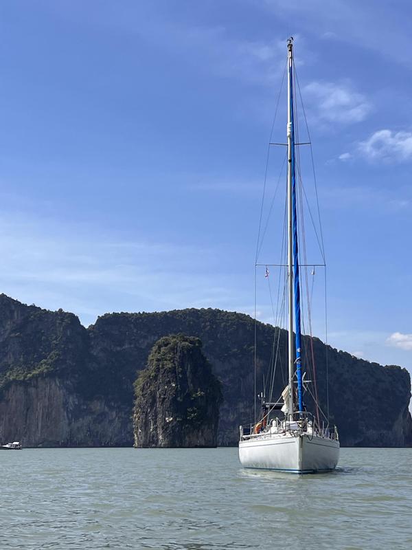
Kurukulla, anchored at James Bond Island, Thailand

Tuesday, 30 July 2019

Marquesas Islands to Tahiti via the Tuamotu Archipelago.

Atuona beach, Hiva Oa
Day one in Atuona, Hiva Oa, was of course taken up with registering our arrival with the Gendarmerie and finding our way around Atuona. After the very simple process of registering we set off up the hill to the cemetery; not normally our first port of call, but this one had the grave of Paul Gauguin which we decided we wanted to see. After that it was into town to get some local currency, French Polynesian Francs (FPF119 to the €), and a lunch stop at the restaurant on the edge of town that had Wi-Fi, to catch up on events of the past three weeks.
Atuoa Cemetery, Grave of Paul Gaugin
From there it was back to Kurukulla via the very well stocked mini market/fuel station on the jetty, and a well earned rest!

After three restful (if slightly roly due to the swell entering) days in the harbour at Atuona, Hiva Oa, we had caught up with our admin, laundry and the world news. The “Societe de Sauvetage en Mer”, run by Sandra and family, was a boon. They operate from the old semaphore station on the east side of the harbour entrance and provide all sorts of services as well as a good internet connection; we spent much time there!

Hanamoenoa Bay, Tahuata
Eventually, having seen enough of Atuona, we decided to stock up with victuals from the local mini-market and, as a last act, go stern to the commercial jetty to take water before departing for the very small island of Tahuata. Our destination was the anchorage at Hanamoenoa Bay on the NW coast. The bay was fantastic, sandy beach and relatively calm, but the weather was not. Just as we prepared to leave Atuona the drizzle set in and we had a windless transit in that cold, penetrating, fine rain that gets in everywhere and soaks you worse than a downpour. It barely stopped before darkness fell at 1800. For the first time in months we were forced to eat supper below decks!

Next day dawned brighter, clearer and calmer. Given the much better conditions I decided it was time for a swim and to clean the brown slime that had accumulated on the waterline of Kurukulla during the Pacific transit. Fortunately it came off with a wipe of a sponge and within an hour she was back to her pristine self.
Anchorage at Vaihatu
The rest of the day passed without us noticing and we determined that the next day we would move to another bay on the island, only two miles away.

The next bay was Vaitahu but, it being Sunday, we deferred going ashore until the next morning. Vaihatu consists of a small hamlet with minimal facilities but it did offer a post office, general store and most importantly Jimmy's bar/restaurant with Wi-Fi. The village church was a quite spectacular semi open air building which seemed almost out of place in such a small community, that said it was also next to the school and therefore at the very centre of life here.
The people were charming, welcoming, and were obviously very content with a simple lifestyle. The bay itself was not a great anchorage and so, after 24 hours here we set off southwards to see if the anchorage at Hapatoni looked any better; it didn't and so we eventually returned to Hanamoenoa Bay which was rapidly becoming our anchorage of choice.

The hamlet at Hanamenu Bay
After two days at anchor we again got the wander lust! This time we set off for Pointe Matahau and Hanamenu Bay on the NW tip of Hiva Oa. After a brisk sail across the gap between Tahuata and Hiva Oa the wind then died and we were faced with motoring the last five miles into Hanamenu Bay. Here we anchored in the company of a single Canadian boat, very different to the frequently crowded Hanamoenoa Bay! Next morning we went for a walk ashore, to discover what was inland behind the small settlement; answer, some ruins which told of a larger settlement in days gone by but very little else. The entire population was less than 20 people and no road access at all.
Pointe Matahau (Great Tower)
If we thought Vaihatu was small! At the entrance to the bay was a most impressive geological formation called Matahau, (Great Tower), from any distance it was almost impossible to believe it was not man made!

Later that day we returned to, you've guessed it, Hanamoenoa Bay, for a final couple of nights before setting off in the early hours of Saturday to return to Atuona for the final time. Our plan was to re-victual there and then set off early next day, south east, to Fatu Hiva, another of the Marquesas Islands. Re-victualling didn't happen because we had forgotten that the shops close from mid-day Saturday until Monday morning!
Towed in by Sauvetage en Mer after being dismasted, poor guy.
We did however witness the arrival of a boat that had been dismasted, and obviously adrift for several weeks, in the tow of the local “Societe de Sauvetage en Mer” rescue boat. We had heard the call for help when at the Semaphore Lookout that morning and were left to presume that it had taken them from 10am to 4pm to tow the crippled boat in. A significant task considering they were in an open boat of only 6 or 7m length. By her condition it was evident she had been adrift for some time and with only one guy onboard.

Next morning we started early with the intention of watering ship before departing Atuona. Unfortunately whilst we were busy recovering the stern anchor and then weighing the main anchor a tug, that had been moored in the harbour overnight attached to a barge which was alongside the jetty, decided to move and take up the only spot on the jetty where we would have been able to get water! We opted to leave without rather than risk the very dodgy manoeuvre of trying to go stern to between the barge and the tug. We managed to do the Pacific crossing on 120 litres (half of our capacity) so we are not desperately short of water but it feels wrong to sail without topping up when it is available.

Cascade d'eau, Hanavave , FatuHiva
From Atuona on Hiva Oa, it was to be a fast reach on port tack to Fatu Hiva, some 46 miles away to the SSE. We finally departed at 0900 and arrived in Hanavave Bay (Bay of Virgins) on Fatu Hiva at 1530; not a bad crossing, average 7 knots. On arrival there were four other craft in the bay and so we sailed in and dropped the anchor in the middle of the group. The bay deepens rapidly as you get further out and our first attempt was unsuccessful, as we fell back on the anchor the depth increased too rapidly; a second try, this time under engine, was more successful and we took a place on the inside of the others near the small dinghy harbour; here we settled for the night. It gets dark here at 1745 in the evening so there are no long evenings to enjoy!

The following day we went ashore to research the local shop (singular) and to walk up to the local Cascade d'eau, (waterfall). The shop was eclectic, a random selection of small quantities of everything from food to hardware. Whilst there we met up with another yacht crew and signed up for a road trip to Omoa, the next (and only other) village on the island, plus an evening diner in the home of one of the locals (there are no restaurants, this is the local alternative); all to take place on the following day. Thereafter we set off with instructions on how to find the waterfall; 45 minutes away. Simple, unless you miss a turning or turn too early. An hour and a half later, having enjoyed a walk through some fantastic countryside, we had given up on the waterfall when we met up with yet another boat crew, they were also trying to find it and had taken the same wrong turning as us.
Looking down on Hanavave Bay
With the aid of a passing local we discovered our mistake and 30 minutes later we were swimming in the pool under the waterfall; cool but not cold and wonderfully refreshing. By 1600 we were back onboard and enjoying a well deserved rest. Just as we were debating the merits of a G&T versus a Rum punch for sundowners, the owner of a catamaran moored near us (same crew as we had met at the waterfall) came over to invite us, and another crew, to drinks onboard. Decision made, they and their boat came from Trinidad so it was a Rum and Coke for sundowners! In fact he was the MD of Powerboats, the next yard along to the one we had stayed in whilst in Trinidad eight months ago. Amazing coincidence! In the end we all stayed not only for drinks but an impromptu supper onboard in exchange for trying to sort out his computer navigation programme which was refusing to function; and still is! A very enjoyable evening indeed.

Omoa to Hanavave, the only main road on Fatu Hiva
The following day we were off on our “taxi ride” to Omoa Bay. The metalled road out of the village lasted for no more than 250m, after that it was slip and slide in 4WD for the next 12km before we reached the 400m of metalled road leading in to Omoa. There were signs of road construction at this end and we were told the plan is to metal the whole distance between the villages but with three small sized concrete mixers (that is all we saw) this is going to take many years I suspect. The risk is that more will be swept away in the rains each year than gets constructed once they get beyond the halfway point! In the evening, as planned, three crews grouped together to dine in the home of one of the locals. A simple meal of chicken, marinated raw fish (in a coconut and lemon marinade) and salad served with breadfruit and rice, followed by local grapefruit as desert; they are larger and sweeter than their European equivalent. All of this was washed down with copious orange juice! The locals don't drink alcohol!

Having seen the anchorage at Omoa we decided it was not worth the effort of going there. It was more exposed, less picturesque and offered no more facilities than we had at Hanavave. For these reasons we stayed put and declared the following day a day of rest; however, we did take the opportunity to refill our water tanks from the source on the quay, two trips with three jerry cans and we were full again. As we had now decided to depart for the Tuamotu Islands from here we spent our final morning getting a stock of frozen meat and a few other perishables from the shop before departing at 1130.
Morning sky, the day of arrival in Iles du Roi Georges
Knowing that our anchor was in the midst of a collection of rocks and boulders I was nervous that it might take us some time and effort to extricate it but in the event it came out easily; phew!

The sail to the Isles du Roi George, (King Georges Islands – must be some British connection) was to be 440 miles down wind, for which we had allowed 4 days. Initially we set a cracking pace and were heading directly for them at 7-8 kts on a broad reach. As we moved further west this became more of a run and our speed reduced to 4-5 kts but, with only a day to go, it was looking good for a daylight arrival, with the sun behind us, as we entered the only channel through the reef. Having the sun behind you makes it much easier to pick out the reef and any other shallow patches as you enter.
The lagoon, Iles du Roi Georges
Although the entrance channel was charted with a minimum depth of 3.5m the remainder of the lagoon was not charted and hence we would need to proceed with extreme caution! As we arrived at the shallowest part of the entrance channel, where a sharp left turn was necessary, a local boat appeared in front of us and very kindly piloted us through the gap. He departed again with a cheery wave and our thanks! From here we headed for the western part of the lagoon, a lee shore but, from the limited information we had, the most easily anchorable part of the lagoon near the village. By 1700 we were anchored with 50m of cable out, in 10m depth, to make sure we didn't drag.

Buoys left by the Black Pearl industry; they're everywhere!
The next day, after a good night's sleep and a light lunch, we went ashore into the “village”. Although there were a variety of houses along the main road and clustered around the church the total population of the island only amounted to ~400 people. Notwithstanding this there was a new school under construction and an extension to the town hall. The former prosperity of the island came from the Black Pearl industry but we were informed by the locals that that had come to an end a few years back and as a consequence many people have now also left the island. The remnants of the industry are still to be seen everywhere, hundreds of redundant plastic buoys piled up in heaps! So taken with the island were we that we decided to stay an extra day. Our plan for a 24 hour stopover became a 48 hour stopover!

Kurukulla, anchored at Teavaroa, Iles du Roi Georges
When we finally did decide to depart it was not to be a simple manoeuvre! Our plan was to leave an hour before sunset to allow us enough time to negotiate the reef in daylight. Thus at 1600 we started to weigh anchor only to find that we had the anchor cable caught under a coral outcrop. It took us over half an hour to extricate ourselves and by this time the sun was low in the sky. The choice was re anchor and spend another night or head for the exit through the reef in failing light, we opted for the latter but it was a difficult exit, this time with no locals to assist. We reached open water just as the sun dropped below the horizon (1745 at this time of year in this part of the world!) and set course for the souther end of the island. As we did so it became increasingly obvious that the East wind we had had for the past several days was no longer and it was firmly in the South South East almost southerly.
Kauehi Island, Tuamotu Archipeligo
This was not what we needed. The winds in July in this part of the world are 95% between NE and SE in July. We had chose the one day when it was not going to comply!

What should have been an 84 mile overnight reach to the Tuamotu island of Kauehi turned into a 130 mile beat to windward. Similarly our planned arrival in the early morning became an arrival at 1830, just after sunset, and an hour before a fullish moon would rise. Not ideal for negotiating the entrance to a coral atoll! The final twist was that we had arrived three hours after high water and so the current was running out of the lagoon at 5-6 knots! All in all not great! The entrance to the lagoon at Kauehi is 150m wide and straight in. This is not difficult navigationally but challenging in the conditions. We opted to give it one try under full sail (the wind was 18kts from the south and we were entering on a north easterly course so it gave us the best chance of beating the current). Just as we were approaching the entrance to the channel, in turbulent water, the echo sounder decided to register a false reading of 7m and reducing, reaching 3m! My nerve cracked and we reversed course and went back out to deeper water. In fact we had never been in water shallower than 250m but in such circumstances it is better to be safe than sorry (or aground!). What next? In true British fashion we hove to, in open water, and prepared dinner! More precisely we had decided to wait two and a half hours until the moon was high in the sky and the tidal flow would be less (as it was by now approaching low water), before making another attempt under engine. At 2200 we were again approaching the channel, the seas were still very rough and confused but this time the echo sounder decided to behave itself.
Land crabs, worse than moles!
In the entrance itself there were standing waves and a current of 5 knots against us and so we edged through making only half a knot at times, a slow and wet process; however, by 2245 we were safely inside and able to make the 7 mile passage across the inside of the lagoon in relative comfort. The channel was marked as surveyed with side scan sonar and so we could be fairly sure that the channel was clear of coral heads and other dangers. By 2359 we were anchored off the village of Tearavero, the largest settlement on the island (perhaps better described as the coral ring). Once sure the anchor was secure we poured two large glasses of rum, downed them with a mug of decaffeinated coffee, before retiring for a much needed nights rest.

The gift from the anonymous children
Next morning we awoke to see a delightful settlement and one other yacht in the anchorage, a bit further in (they had obviously arrived in daylight!). A scene of calm and tranquillity. We settled for a days rest! In the afternoon we wandered ashore to meet some of the locals and to report our presence to the Mairie (a requirement when in the UNESCO Biosphere Reserve, of which this island forms part). The people were again absolutely delightful, the island seemed well organised if not affluent and the shops (there were two) stocked with essentials but not much else. The saddest aspect was that several houses were lying abandoned, their occupants seemingly having relocated off the island and again there was much evidence of pearl farming having been and gone!

The following day we went ashore again, just to stretch our legs and access the internet. On our return to the dinghy we discovered a small decoration, made from palm fronds, had been left for us on the thwart. Further investigation revealed that it had been made by the local children and left for us as a present. Amazing kindness! Sadly the children were no longer there for us to thank them personally.

Kurukulla at anchor, Toau Island.
After two days anchored in Kauehi we set off at 0600 for Toau, another coral island. An early morning start was essential if we were to avoid another “washing machine” ride out through the entrance. As it was, at 0715, we caught the first of the ebb tide and had a relatively pleasant passage out; we were following another New Zealand registered yacht who had chosen to make their escape at the same time. From here it was a 36 mile passage, west, to the Otugi passage at Toau which meant, if we could maintain an average of 6 kts, that we would be entering downwind, on the first of the flood tide, again an ideal situation. In the event the Otugi passage was a non event! Although there was a 1m swell running, it was not breaking in the entrance, despite the depth being only 6m. Once inside it was a flat water sail to the anchorage a mile to the south. A piece of paradise; there were two other yachts anchored off the beach but it was 1.5 miles long so not crowded!
Never go without your hat, Toau Island!
We sailed onto the anchor in 10m of water and settled for a slightly delayed lunch whilst we soaked in our surroundings. Here we stayed for two days enjoying the tranquillity and totally unspoilt environment. Whilst we were here two other yachts arrived so it is obviously recommended in somebody's cruising guide; it is not the sort of place you chose to enter by chance! There was plenty of space for all however.

Our next stop was to be the island of Apataki, 39 miles away.
Arriving Pakaka Pass, Apataki
This atoll has two passes by which to enter/leave the lagoon, SW and NW. Our plan was to enter by the former and leave by the latter. For this we needed to be off the SW entrance by 1400 to catch the start of the flood tide; another early start! At 0700 we weighed anchor and set off for the entrance followed by a German yacht anchored near us. The passage through the pass was quick but lumpy, another “washing machine” ride, but this time we made it through in much less time. From there it was a broad reach to the Pakaka Pass giving entry to the lagoon at Apataki. Facing SW this pass was in the lee of the island and relatively calm; it is also well marked. Once inside we made for Tamaro, on the SE corner of the Atoll, 8 miles away.
Apataki, not much detail!
Directly upwind in sparsely charted waters we opted to motor there. En route we passed two coral heads breaking the surface, neither of which was shown on our chart and both were surrounded by water 30+ metres deep! If you don't see them you hit them, no good trusting the echo sounder!
Boat-yard at Tamaro, Apataki
As we approached Tamaro we noticed lots of masts in amongst the trees and to our surprise discovered a boat yard in this remotest of spots. Who on earth leaves their boat ashore here miles from any centre of population and with no transport links?

Next morning we were visited by an Australian couple who answered part of the above question. They were living on their catamaran, moored here, whilst doing up another catamaran that they had bought at auction in Tahiti; a drug runner's boat that had been seized by the Gendarmerie. Their plan was to turn it around in 9 months, sell it in Tahiti, and be away before the Typhoon season. A good deal if you can do it! Ashore were also another dozen or so boats in various stages of repair and, whilst we were ashore, they lifted out a further two, so no lack of trade! The down side was that there are no shore facilities to speak of.
Christoph on lookout duty. En route north in the lagoon, Apataki
The boatyard office keeps a small quantity of essentials but otherwise everything has to come in on the once per week boat or the weekly flight, including all foodstuffs. The only shop is 14 miles away, across the lagoon, near the pass by which we entered! At mid-day we took our leave and headed north to the next anchorage in the NE corner of the lagoon. With Christoph in the bow, keeping watch, we navigated our way through the coral heads in uncharted waters. It was a beam reach, in flat water (average depth 20-30m) and we were doing 7-8kts! The only problem encountered was not with the coral but with a fishing boat that intercepted us warning us of their nets cast across our intended path.
Anchorage at Teonemahina point, Apataki
After a brief tack to windward we rounded the windward end of their net, waved them goodbye, and continued on our way. By 1400 we were anchored again at Teonemahina Point, another piece of paradise and totally deserted. The anchorage was on sand, in 7m, and ideal for a nights stay.

At 1130 the next day we set sail again, this time downwind, to close the distance to the exit pass at Tehere. Although our plan was to exit just before sunset, at low water, we decided to make the transit across the uncharted lagoon whilst the sun was still high in the sky, making any coral heads more easily visible.
Coral Head (uncharted) in midst of Apataki lagoon. We were in 30m!
We then anchored near the pass to await low water, at 1630, before making or departure to Rangiroa; our last port of call in the Tuamotu archipelago. 

The reach to Rangiroa was quick and comfortable but we arrived two hours before sunrise, hence we spent those hours hove to, three miles off the Tiputa Pass, waiting for enough light to enter by. The entrance is straightforward but once inside it is difficult to find any decent anchorage off the village, in the dark. The areas free of coral outcrops are generally too far off the beach to be anchorable, hence daylight is essential to find a suitable coral free area. No sooner had we dropped anchor we were hit by a vicious squall, heavy rain and 30+ knots of wind.
Disused church, Tiputa, Rangiroa
Fortunately the anchor held and we were able to watch it pass from the dry comfort of the cabin, it was only when we came to depart that we found out just how securely the anchor had jammed itself in the coral, again!

The village of Tiputa boasted three shops and a post office (with ATM) plus a disused church. A glimpse inside showed it to have been almost stripped bare; whether this was a precursor to major restoration or a permanent move to another location wasn't immediately obvious. There was also a small cafe at the landing stage which offered Wi-Fi, hence we spent a fair amount of time there, catching up on the news (Boris Johnson becoming Prime Minister!) and our own personal admin. After 30 hours anchored off Tiputa it was time to leave. In the early afternoon we weighed anchor (with difficulty!) and set off for the Avatoru pass, 5 miles west, and once out set sail for Tahiti. It was to be a cracking good reach averaging 7.5kts over the first 8 hours.
Panorama of Makatea
To avoid arriving in Tahiti in the late evening and having to hold off again and wait for daylight we decided to break our journey at Makatea, an isolated island, a third of the way between Rangiroa and Tahiti.

Although the island has no suitable anchorages the local government had reputedly (according to the “Stopover Handbook for Polynesia) laid three moorings for visiting yachts, our hope was to pick up one of these. On arrival we found a catamaran moored to one of the moorings and no sign of the other two! It was pitch black, the moon had yet to rise and sun rise was four hours off, hence we were not keen to get too near the fringe of the reef on which Makatea stands.
Our wanderings through the Tamamotu Archipelago and to Tahiti
We hove to again! At daybreak all was revealed; the other two moorings did exist but were very close to the edge of the reef, much closer than we were prepared to go in the darkness! Just as we approached to pick up the buoy a whale lazily crossed our path, broaching the surface less than100m away, before disappearing southwards. The remains of the extensive loading facilities, used to load phosphate rock, that was mined by British and French interests from 1908 until supplies were exhausted in 1966, were very evident; built right on the edge of the reef. At 100m from the shoreline the depth was still over 150m, hence the moorings being so close inshore! Once we were secure we settled in for a quiet and relaxing morning! Our intention was to depart again at mid-day... which we did.

The first part of the crossing to Tahiti was a beam reach in 16-18kts of wind, plenty of rolling on the swell but otherwise not uncomfortable. Then night set in and the winds steadily rose in strength; fortunately for us they did not change much in direction but by the time we reached Tahiti, at 0800 in the morning, we had winds of force 7 gusting gale 8 and were under a double reefed mainsail and a pocket handkerchief of Genoa.
Arriving Tahiti
This was our first gale since leaving the Mediterranean; not bad! On arrival we chose the nearest protected anchorage, dropped anchor inside the reef, and set about drying things out (our foul weather gear and things affected by a few very minor leaks) before settling for a morning of sleep to catch up. Amusingly the welcoming SMS from 3 welcomed us to Argentina (Geography is obviously not their strong point!). They also allowed us to receive other incoming SMS but flatly refused to let us send any. Joys of technology! Our plan from here was to spend the rest of the day and night at anchor before moving into the Tahiti Yacht Club the morning after.
Tahiti Yacht Club, Papeete
This we did, after a confirmatory phone call to check the availability of a berth. By 1300 we were alongside, secure and ready to explore the locality, including the local Carrefour supermarket; such a joy after the tiny general stores of the smaller islands of Polynesia and the American style supermarkets of the Caribbean. Food here is on average 30-40% more expensive than in UK/France but the choices available look similar; a small price to pay!

More on Tahiti and the voyage west when we arrive in Fiji our next major port of call…....


Friday, 28 June 2019

Panama to the Marquesas via the Galapagos Islands.


Our track - Panama to Marquesas

Departing Panama
The final departure from Panama was ultimately uneventful. We spent the morning of Wednesday, 29th May, buying last minute items, clearing out with immigration, getting our new Zarpe (departure permit) from the Maritime Authority and finally filling up with water and fuel before paying the marina bill. By 1200 we were hauling off the berth and heading south. As we had not taken electrical power in the marina (only 120V available) we motored for the first hour to get clear of the big ship traffic in the approaches to the canal and to fully charge the batteries. As soon as we were clear we hoisted sail and set off, on the wind, on our second journey southwards. This time it was a beat southwards, just our luck, but at least there was wind, most of the time; we only suffered one period of two hours drifting, waiting for the wind to return.
Departing Panama - back to the normal dress code!
As we headed south the wind slowly backed to the east and we eventually managed to clear Punta Mala, the westerly side of the canal approach, by 1600 the following day. Later that night the wind veered strongly to the west and we took the decision to tack and cross the shipping lanes. With only one ship to avoid this was easily done and we were heading SSW in our desired direction.

We headed south as best we could, playing the wind shifts to our advantage, until, three days later, on June 2nd, we were 100 miles off the coast of Colombia/Ecuador in water 1500m deep. Imagine his surprise when Christoph, who was on watch, spotted a fishing float in our path! Was it a drift net or was it a drugs haul/drop off? He was even more surprised to hear voices over his left shoulder when the fishermen whose net it was, hailed us from their open, 7-8m long boat! They were friendly enough but this is one heck of a long way to be offshore in such a small open boat! This was one of four such boats plus their nets that we passed in the following four hours; the final one was 125 miles from the nearest land!
Our first land on!
One wonders how may of these guys fail to return each year? After the first net we had tacked for the final time and were now headed directly for the Galapagos Islands, 500 miles away to the WSW.

From here on it was all port tack at speeds between 4 and 8 knots. Soon after tacking we picked up some hitch-hikers. A family of sea birds adopted us and were hitching a ride on our pulpit. First one landed on, then two and finally we had five onboard intermittently. It was a bit like being in an aircraft carrier with the fixed wing aviators doing DLPs' (Deck Landing Practice).
The family gathers
They would take off every so often, fly round Kurukulla whilst searching for food, and then come back and land on again. Mostly their food seemed to consist of small flying fish put to flight by our approach. This went on day and night with them flying close under the starboard bow hunting by the green light of the starboard navigation light. It has to be said, after a bit of practice, their day time deck landings were getting quite accurate, night-time remained “hit and miss”! Landing on a polished stainless steel bar, moving at 7-8 knots and randomly up and down, as Kurukulla pitched in the waves, was no mean feat, nor was staying in place as the waves threw spray over the bow as we surged onwards. Ultimately they stayed with us for four days, 500 miles, until we reached Galapagos!

At 0600 on the 5th of June, just before dawn broke, we were 80 miles short of the Galapagos Islands; it was here that we crossed the Equator;
The Lat & Long when crossing the line.
I was on watch but shook Christoph in order that we could enjoy a bottle of “bubbly” to celebrate the moment. Our plan was to arrive at the Galapagos islands at daybreak the next day, sail northwards through the islands, but not stop. Given the amount of time we had lost in Panama doing repairs, plus the high cost and ridiculously severe constraints placed on private boats that visit the islands (all designed to maximise revenue for the local tourism companies!), we had decided not to stop but do a “windscreen tour” whilst on innocent passage through the islands.
Yes I do occasionally wear clothes..
Had we have stopped we would have been constrained to stay in one of four harbours at a cost of ~£1000 in charges for agents, clearance etc. and then pay again to visit the outer islands by tourist boat, not my scene!

A cautionary tale, (those who are not boat owners/skippers may wish to skip this paragraph)! As we approached the Galapagos Islands I had noted that there were upwards of fifty AIS contacts scattered in and amongst the islands. However, next time I looked there were none! Atmospheric effects around sunset? It was only next morning when I was seated at the chart table and switched off the navigation lights that I realised that they had all suddenly re-appeared! Switch on the navigation lights all disappeared again. The radio frequency (RF) interference from the LED navigation lights was totally blanking out AIS reception! The same may well apply to your VHF reception! Moral, check for mutual interference if you use LED lamps and, if you do, don't trust your safety to AIS at night. I am now searching for a supplier of RF suppressed LED lamps!
Downwind through Galapagos Islands

Initially we had to slow down so as to make the bottom end of the Canal Isabela; which separates Isla Santa Cruz and Isla Isabela, the two main islands of the Galapagos archipelago; at daybreak on Thursday, 6th of June; this was in order that we would have daylight enough see the scenery.

The day dawned grey and so were the islands; nothing like the scenes in the film “Master and Commander”! In fact that morning the wind died away to nothing and despite setting the spinnaker we were still only able to do 3-4 knots up the channel. In one of the quieter moments we went for the first swim since leaving Panama; very refreshing! It took us over 24 hours to do less than 90 miles! In the process we also recrossed the Equator again; this time, going northwards; our celebrations were rather more restrained .. a beer with lunch!

In terms of wildlife we did sight the largest pod of dolphins that I have ever seen only hours before we reached Galapagos and we saw a pair of sea lions playing in our wake as we transited the canal but beyond this nothing special; for the rest you have to pay and tour the islands by tourist boat or on foot.

Galapagos Islands (in passing)
We finally exited the Canal Isabella at 0200 on the 7th of June and set sail for the Marquesas Islands, in French Polynesia, which were some 2900 miles ahead of us. Escaping the Galapagos Islands was not going to be that easy however, by 0500 we were becalmed and stayed that way for the next three hours; managing only 1-2 kts. Eventually the wind filled in and we were off; a close reach, on port tack, riding the trade winds at 7 kts. Again, within hours of departing we were surrounded by dolphins, hundreds of them leaping and playing in the waves. These are smaller than their Atlantic counterparts and do not seem to relish playing in the bow wave of the boat as their Atlantic compatriots do. Fascinating none the less!

Christoph's pressure cooker bread
Today was the day when our supplies of commercially baked bread ran out. There are limits to it's keeping qualities! As a consequence Christoph set to and produced us a loaf of “Pressure cooker bread” and very good it was too. Normal dough but cooked on the stove top in the pressure cooker (not under pressure). One of his best loaves to date! At 1445 we crossed the equator for the third and final time in this stretch. This time our celebrations were even more restrained; a glass of red wine, left over from dinner yesterday, to accompany our lunch. We are now going to be in the southern hemisphere until we reach Indonesia, late next year.

Amazing sunrise in mid Paciific
Life on a long passage gets into a set routine and this passage was set to be 4050 miles in total. Christoph and I had agreed that we would split the day into four watches, he would take the eight till two slots and I would take the two till eight. That way we would each be able to get some uninterrupted sleep in our periods off watch. Breakfast and lunch were snack type meals and we took it in turns to prepare dinner, saving the more adventurous menus for the calmer days! Cooking “Coq au vin” at 20 degrees of tilt, or on a rolling platform, is no joke! Our best days mileage was 198 in 24 hours, averaging just over 8.3 knots; not bad for a 39 foot boat! The next day we broke another record for the number of flying fish on deck at dawn; we had 18 on deck (plus two squid) and that doesn't count the 9+ that Christoph and I had rescued from the cockpit area and thrown back in the sea, nor those that flipped back over the side of their own accord.
The morning deck clearance!
I remember from my days at sea in the Royal Navy that our Hong Kong laundrymen, who we carried onboard as contractors, would do an early morning sweep of the deck for flying fish and that was breakfast! Somehow, despite the fact they were fresh, Christoph and I couldn't bring ourselves to eat them. They are appallingly slimy and shed scales everywhere. Preparing them would be a complete nightmare!

As the days passed the winds came round to be more and more from astern until, 1000 miles short of the Marquesas, we were able to pole out the genoa and run downwind at 7-8 knots in 12 to 20 knots of wind. All very easy! The days merged one into another, other than the odd amusing event. On the night of the 17th June it was Christoph's turn to be struck by a flying fish. Just as we finished dinner it came inboard like a missile and struck him on the side of the neck before landing on the helmsman's seat and then flipping itself back over the side. He, as you can imagine, was less than amused: especially as he had put a clean shirt on only an hour before, which was now horribly sticky round the collar and reeked of fish!

Christoph on watch
Two nights before reaching the Marquesas Islands we sighted our first fishing vessel since the three seen when leaving the Galapagos Islands. Other than these boats plus one ketch which crossed our path halfway, looking to be en route from Pitcairn to Mexico and an Australian sailing vessel of similar size to Kurukulla, on a parallel course to us, encountered one day out from the Marquesas, we did not see another living soul in sixteen days! The Pacific is amazingly empty! Having said that, of the four fishing vessels we have passed, we were on a collision course with two of them before we altered to avoid; it proves the value of continuous watch-keeping and the risk to single-handers!

Sunrise over Mohotani
Typically we sighted the Marquesas Islands at dusk on 23rd of June meaning that we would not be able to enter harbour until the following morning. To enter by night, in a strange harbour where most boats are anchored head and stern, did not seem a good option! As a result we altered course to port and headed for the small island of Mohotani where we could find shelter from the swell and space to heave to overnight for a good night's rest. At 0600 next morning we set off again for Atuona on the island of Hiva Oa, our port of entry.
The final leg...
By 0930 we were anchored in the quietest part of the harbour and ready to go ashore and find the Gendarmerie where we had to report. All went well, no problems at all. One form to fill in that covers the whole of French Polynesia and we were then entrusted to take it to the post office and despatch it to the central authorities! All so simple.

The island is delightful, the people very welcoming and the chance for a rest very much enjoyed.
Atuona harbour, Hiva Oa

More after we leave Hiva Oa.....

Wednesday, 29 May 2019

Jamaica to Panama and through the canal...


Departing Santiago de Cuba
According to the pilot the passage from Santiago de Cuba to Port Antonio, Jamaica, is a straightforward beam reach, in almost all of the trade wind season; that is unless you are in Kurukulla! We departed Santiago at 1400 on Tuesday expecting to arrive in Port Antonio, 120 miles SSW in the late afternoon of the next day after a simple overnight sail. It was not to be. Almost as soon as we left the Cuban coast behind the wind went to SSW and dropped to light and variable; and there it stayed for 24 hours before dropping away completely! We tacked the wind shifts all the way and in the last three hours had to resort to the engine in no wind conditions. Eventually, at 0200, we dropped anchor in the East Bay of Port Antonio, 36 hours after departure!
The paperchase on arrival in Jamaica!
Fortunately it was a simple entrance even in the pitch dark.

Next morning, after a brief swim, we set off into West Bay, berthed at the Errol Flynn Marina, and set about filling in the multitude of forms needed to get us officially into Jamaica, more than I have seen anywhere else! After visits from Public Health, Immigration and Customs we were finally in, all we had to do now was register with the Marina Authorities. That done it was time for a beer in the marina bar....

Errol Flynn Marina, Jamaica
The plan was to spend the following day, Saturday, sightseeing in Port Antonio before setting off for the south coast and Kingston on the Sunday morning. “The best laid plans” as they say! On Saturday morning I went to get some local cash from the Scotia Bank ATM; all went well until the machine counted the cash and invited me to retrieve my card and take my cash; neither appeared! We were now destined to stay until Monday morning so that I could go to the bank and retrieve my card. I was not the only one; there were four of us outside the bank, at 0830 on the Monday morning, on the same mission. To fill the time we spent Sunday visiting the beautiful beach at Frenchman's Cove; a private beach with bar and extensive gardens attached.
Frenchman's Cove. Great beach..

After the bank saga, on Monday morning, we were finally ready to go and at mid day we set off for Port Morant, the most easterly anchorage on the south coast of Jamaica. A beat northwards out of Port Antonio augured well for a fast reach eastwards to the eastern tip of Jamaica, but no, as we turned east so did the wind and we ended up beating to windward for the whole day, resorting to the engine late in the day in order to arrive not long after sunset. Another night entry saw us anchored at the northern end of the anchorage by 2030, near the Marine Police base (very safe), and waiting to see more of where we had anchored in the daylight of the next morning..
Morant Bay, a good anchorage.

In the event the bay was beautiful but a relatively early departure was needed if we were to make our next anchorage in daylight and so, after checking the propeller for ropes (we had had a close encounter with a fisherman's float in the half light of the night before; he usual clear plastic bottles tied together) we set off for Portland Kay, just south of Kingston. After a day of motor sailing, due to lack of wind, we anchored, at 1730, off of the idyllic sandy island of Big Half Moon Cay just as the sky turned black and the wind got up for the first time in the day. Great!
Anchored off Portland Cay
Our long awaited swim in the calm waters of the Cays was going to have to wait for another day! Within 10 minutes of anchoring we had 18 kts of wind and a thunder storm threatening! Just what we needed.

The following morning however made up for it. We were anchored in the midst of a mirror flat sea with the sun beating down on us from the azure blue sky of the very early morning. Paradise! Simon and Christoph swam ashore to go beach-combing (they are both avid collectors!) whilst I stayed aboard to do a bit of navigation planning for the next few days. By 0945 we were underway navigating back out of the reef and heading for Alligator Cay some 25 miles to the west; sadly under engine; there was no wind! We arrived 90 mins before sunset but with black clouds gathering to the east of us. Sure enough within 15 mins of anchoring the sky was black and the rain started, lasting until well after sunset! Just our luck. Novel though, to be anchored in the midst of nowhere with only a very few coral outcrops for company, some three miles offshore.

Sunset, Black River Bay
Next morning was somewhat better but what little wind there was didn't last. After a swim to the nearest outcrop and a bit of beach-combing we were ready to depart. We sailed off the anchor but it was not to last, 15 minutes later we were motoring west again in virtually zero wind, a situation that lasted most of the day; we were occasionally able to motor sail but only managed an hour or so of true sailing. By 1730 we were anchored in Malcolm Bay, just to the west of the mouth of Black River which is home to Jamaica's largest population of alligators! Strangely a post anchoring swim didn't seem to be a popular option!.
South of Negril Point

The anchorage was in the middle of a wide, deserted sandy bay. Superb but ,as we had to make Negril by Saturday (24 hours away) for Simon to catch his flight, loitering here for a day was not an option. The forecast for Friday was easterly winds, the reality was light wind from the west! Thus it was that we set off at 0900 to beat to windward the 30 miles to Negril in 10 kts of westerly wind and brilliant sunshine; not all bad.....

By 1800 we were entering Negril Bay and anchoring inside the reef. It was relatively calm but the wind had gotten up from the north east in the final hour and that had put up a decent chop, sending spray flying, as we entered the bay. Notwithstanding, we sailed onto the anchor and joined the other few yachts anchored there.
Negril Bay
Round the bay, tripper, catamarans were in abundance and we received the usual shouts and applause when they realised we were dressed in Kurukulla's normal dress style! Once they had departed for the night we settled down to supper, accompanied by the usual reggae beat echoing from the shore.


Next morning dawn ushered in a still and overcast morning. It was Simon's departure day so the morning was taken up with him preparing his travel-bags and the afternoon was spent over a leisurely lunch and a final farewell. From there Christoph and I returned onboard for a quiet night and a relaxing day at anchor the day after.

On the Monday morning the wind was steadily in the east and hence we were in no hurry to set off towards Montego Bay as our first overnight stop was only 20 miles away and would be a close reach. Wrong! We departed after lunch and set off for Lucea, a protected bay on the NW coast but as soon as we rounded North Negril Point the wind went on the nose yet again! It was a six hour beat to windward to reach Lucea and we arrived just after dark.
Montego Bay Yacht Club
Although the entrance was simple I attempted to cut the western headland a bit too fine (I should have put my glasses on when looking at the chart!) and we had a slight shock on entry when several vertical piles loomed out of the darkness ahead of us in what I was expecting to be a clear channel! Moral always look closely at the chart and don't trust a quick glimpse. A quick turn to port and the problem was solved but also a lesson learnt; keep your reading glasses around your neck when navigating in darkness!

The birthday celebrations
After a quiet night at anchor in the large but tranquil bay at Lucea we set off next morning for the marina at Montego Bay. We had phoned ahead and booked a berth for two nights to ensure we were alongside in order to facilitate re-victualling, departure clearances and celebrating my birthday etc. Although my birthday was not until the Friday, officially, we opted to celebrate on the Thursday night as it was already the actual day in UK and time was pressing for us to depart for Panama. After a trip to the local supermarket and a very enjoyable celebratory dinner in the club (marked by a chorus formed of all the waiting and bar staff singing “Happy Birthday to you”; very embarrassing!) we set off on the Friday morning with a slight hangover and the intention to get a good nights rest back in Negril Bay before setting off for Panama early next morning.

One handed steering!
The first part of the plan worked well, we got an excellent nights sleep in the Negril anchorage; the only minor problem was that we woke the day after to a completely windless morning! Although we weighed anchor at 0800 we had barely cleared the bay by mid day! “Hoist the iron foresail”. We motored for the next 8 hours on a calm and windless sea before the wind finally set in from the east at 2000, just in time to make serving dinner more of a challenge! By 2200 we had 15-20kts of wind and were doing 7+ knots. Much better, even if the sea was on the beam causing us to roll heavily. Three days later and we were only 60 miles short of the Canal Entrance, our prognosis was that we would arrive in the early to mid morning; it was then that the wind dropped away and left us rolling heavily in a very light NE breeze of 6 kts or so.
Arriving Colon, Panama
Far from ideal. We kept going and altered course to make best speed in the light winds but by 1000 next morning we still had 30 miles to go and were much further east than we had intended. An hour later we gave up the battle and hoisted the “iron foresail” for a second time and motored directly towards the harbour entrance at Puerto Colon. By 1600 we were through the harbour entrance and heading for “The Flats”, the anchorage where all small vessels are required to wait whilst they arrange their passage, or so we thought! On arrival in “The Flats”we had one tanker for company and not a single other small craft! Obviously something had changed! A quick search on the internet (thank goodness for the internet) and we discovered that the Panama Yacht Club had been demolished and a new waiting area, in the vicinity of Shelter Bay, had been established in the far north western corner of the harbour, 2.75 miles away. Forty minutes later and we were anchored amongst 10 other boats in the “New Flats” and preparing supper in comfort, in contrast to the rolling motion of the past 5 days.

Not bad for 15 months in the water
Next morning I made a quick phone call to Shelter Bay Marina, which is now the centre of small boat transit management. Within two minutes we had a berth arranged into which we moved at 1000. From here it was Immigration and the Port Captain's office to get legally into Panama and a “Cruising Permit” to allow us to stay in Panamanian waters for more than 72 hours. After three hours we had still not achieved either! The Port Captain arrived for work at 1145 but the Immigration official (who looked barely old enough to be in long trousers) was leaving at 1230, and, you've guessed it. We needed the papers from the Port Captain before we could complete Immigration and to make matters worse the Cruising Permit had to be collected from Colon, an hours drive away or pay US$50 extra for the Port Captain to collect it for us … we paid! Both the Immigration officer and the Port Captain stated that they would be in office next day from 0800. We arrived at 0900 and they arrived at 1100 and 1130 respectively, time means nothing in Panama unless you miss your transit booking, then it gets expensive. We met a couple who had paid for their transit, US$800 plus $300 “extras”, only to suffer an engine failure and miss their slot. In the wake of their engine repair they had insufficient funds to pay again for a revised transit and were stuck between a rock and a hard place!

Having arrived in the evening of the 9th of April it was the 10th before we could get started on the process of organising a transit. For simplicity we opted to use an agent for booking our transit. In the great scheme of things his US$ 300 fee didn't seem that bad! We made contact on the morning of the 10th with Erick Galvez, one of the more highly recommended agents. He replied immediately with a questionnaire that we completed and returned. Before you can book a transit it is necessary to have your vessel inspected and measured, this booking was his first task. The earliest inspection date available was in the morning of Friday the 12th of April. The inspector duly arrived at 1230, spent a convivial 45 minutes with us, measured Kurukulla's length over all protrusions, issued us our SIN (Ship Identification Number) and departed saying that we would have a transit date by that evening. Good to his word Erick came back with an earliest transit date of Sunday 21 April; 9 days hence! Although we would have preferred an earlier transit this was not too disappointing as we had already decided to haul out and re-antifoul Kurukulla's bottom either before or after the transit; the delay made our mind up for us.
But here was the problem....
We would haul out at Shelter Bay Marina. By now the marina office was closed and hence first thing next morning I was on the doorstep to arrange the haul out. The problem was that the “lady what does” the arrangements was not working Saturday but would be in tomorrow and “No, it was not possible to haul out today because she was not here to arrange it”. Sunday morning I was again on the marina office doorstep at 0800 and yes she was there. Unfortunately there were no slots to haul out before Tuesday morning and sadly we had missed an available slot the day beforeSaturday. I won't repeat what I muttered under my breath! Even now hauling out was still worthwhile, it just meant we would have to work harder and faster to get all the underwater work done in time for a Thursday relaunch (Friday was a public holiday; just our luck!). The fallback was relaunching Saturday but to my mind that was cutting things too close with our transit booked for the day after.

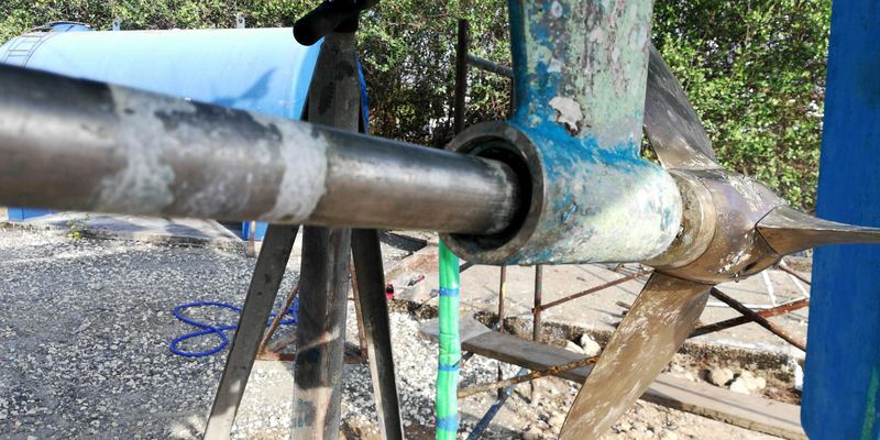
Plans, however, are a basis for change! On hauling out all initially looked well but on closer inspection it was obvious that our Cutlass Rubber bearing in the P bracket, the bracket that supports the propeller under the hull, was well worn out. Our time in the aggressive marine growth of Trinidad had taken its toll. A layer of calcium had built up on the propeller shaft and effectively machined away the bearing. A new bearing was needed which requires removing the shaft and that in turn means changing the stern seal as well. Both were original to when I bought Kurukulla in 2006 so they had lasted well. The problem now was finding spares in Panama. The local chandlery, operated by Lloyd, has a very limited stock and almost nothing in metric sizes. Lloyd himself is a very willing guy and spent almost a whole day researching all the suppliers in Colon and Panama City, to no avail.
Re anti-fouled and almost ready but .....
Ultimately I had to resort to inviting a very good friend, Mike, who lives in London, to act as forwarding agent. I ordered the pieces via the internet, from 3 different companies in UK, on Thursday 18th of April; for them to be delivered to him and for him then to consolidate them into one package and forward it to Panama by FedEx. All of this over the Easter weekend! Our plan to transit the canal on Sunday was obviously a non starter and very fortunately Erick, our agent, managed to defer the transit, at no additional cost, to a date yet to be confirmed. The advantage of using an agent!

In the ensuing days we removed the prop shaft and old bearing plus the stern seal, re-antifouled the hull, had the topsides polished and set about other general maintenance onboard. We had plenty of time on our hands! Fortunately the marina had a decent bar/restaurant and swimming pool. There are some compensations! One slightly alarming aspect was meeting up with a Canadian crew who had been set upon by pirates/rogue fishermen, off the coast of Ecuador, as they sailed south towards Panama. They were first approached by two small boats 30 miles off the coast; the boat crews requested beer and money before departing, not an unusual event; only this lot came back with two more boats some time later. Fortunately the yacht crew escaped unharmed, if traumatised.
They had sent out a “Mayday” call on Chanel 16 and fired off red distress flares but all to no avail. The pirates rammed their boat several times, broke several windows but were unable to get inside the boat, where the crew had taken refuge behind metal grills fitted to the hatches (these they had had made before leaving Canada). Eventually the pirates departed taking all the upper deck electronics, which they had wrenched from their housings, probably wrecking them in the process, and anything else of value that they could find on the upper deck of the yacht. Fortunately Ecuador is not on our route!

And we think we have problems! Their keel is completely rotten!
Of the three different suppliers; the two forwarded the parts via Royal Mail and these arrived Easter Saturday; unfortunately the one piece forwarded by FedEx arrived the Tuesday after (next “working day” service!). Within 2 hours of the final piece arriving Mike had them consolidated into a single package and back in the hands of the FedEx depot at Feltham, London, it was now 1430 Tuesday. Via their tracking system we received a forecast delivery in Panama of “Thursday 25th April by 1800”. Needless to say Thursday 25th came and went with no spares delivered. According to the tracking system it took 24 hours to get the 4700 miles from UK to Panama, via Memphis and BogotĂĄ, and arrived in Panama at 1510 local on Wednesday. The next 40 miles took 47 hours with the package finally arriving at 1430 on Friday; notwithstanding the fact that we had paid extra for “FedEx International Priority, Express Package Service”! I am not sure what our extra investment bought?

New bearing in and prop like new!
With the parts in hand, on Saturday, we set about fitting the new bearing and stern seal. Bearing first. It was an excessively tight fit and after many hours of sanding it down and using a puller to get it into the P bracket we had it 70% in. The problem was, no matter what we did, it was neither going in any further nor coming out! We and it were stuck! There had to be a reason...and for a few hours it eluded me; no mention at all of the P bracket in the Boat Handbook; then “the penny dropped”. Although the shaft was 30mm diameter the bearing housing was not 45mm diameter as we had measured, it was 1¾ inches, which equates to 44.45mm i.e. just over half a millimetre less. Hence the one we had had delivered from UK was never going to fit! Why an Italian boat builder installed a P bracket that requires a bearing in a mixture of metric and imperial measurements goodness only knows but that is what it is! Net result we were going to have to order another bearing, of the correct dimensions, from UK, via a courier. Oh joy... I wont tell you what I said but the air was blue!

On the move back in!
At 0300 on the Monday morning (0900 UK time) I was seated at the computer talking to Tom at Exalto Bearings in Derby UK; he was very efficient and fully understood my problem. Within 2 hours a second pair of bearings were on their way via DHL; two in order to give me a spare; just in case! DHL were forecasting delivery for Friday, four days hence, so not too severe a delay. Now to sit and wait.... By 0130 local, on Wednesday, DHL web tracking showed it was already in Panama awaiting clearance; amazing; however, Wednesday was May 1st, a public holiday, hence nothing was going to move again until start of the working day on Thursday. “Every time a coconut” or should I say a public holiday! Thursday came and went as did Friday … no bearings …. “Clearance delays” being the excuse. The only entertaining part of the day was sighting an alligator swimming silently around the marina in between the boats. No swimming here then (other than in the pool)!

First thing on Monday morning I contacted the bearing suppliers and enlisted their help to “kick” (their words not mine) DHL. Suddenly, an hour later, I started to get messages from DHL saying it was on the move! Later in the day the marina office also informed me they had received an e-mail stating delivery would be Tuesday; eight days after collection and six days after it arrived in Panama. Amazingly it actually arrived, at 1230 Tuesday! Moral of the tale...for deliveries to Panama use FedEx; never DHL. By 1600 we had the new bearing in (a tight push fit) and decided to delay installing the new stern seal until the following day when the light in the depths of the after cabin would be better. By mid-day Wednesday all was back together and ready for relaunch the following day, all that was needed now was a new date for a transit!

Evening still in Shelter Bay Marina
The relaunch went well as did the sea trials, no leaks, no problems. 7 knots recorded under engine where the minimum required for a canal transit is 5. Erick, the agent, worked some sort of magic and got us a transit for the Saturday, two days hence! By the time we came back from the sea trials the fenders (8 large) and warps (4 x 120ft x 1”dia!) for the transit were already awaiting us on the jetty! By close of play Friday all was ready. Andrew, a member of the Canadian Coastguard, had volunteered to act as a line handler and the agents provided the other two ($100 a head), that with Christoph made the four necessary. All was set.....

Canal advisor arrives.
By midday Saturday our two local line handlers had boarded and we set off for the Flats anchorage where we had to anchor and await further instructions from Port Control, plus the arrival of our Canal Adviser. From here it is mandatory to call Cristobal Signal Station and report your readiness to transit. In return you are given an arrival time for your Adviser, ours was due at 1630, so no move before then.....

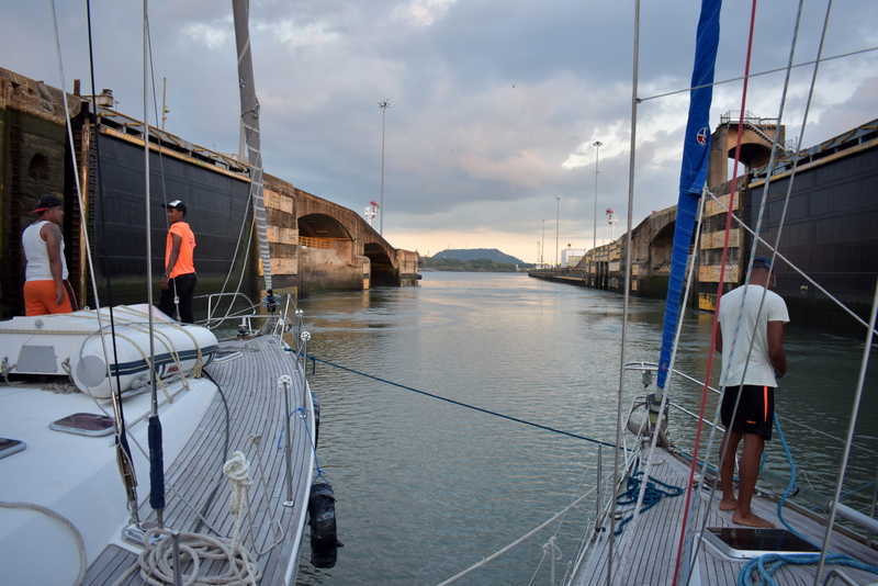
Good to their word the “Advisor” arrived at 1630 and we were in the first lock by 1730, out of the top lock at GatĂșn by 1915; after which we were required to moor to a large (3m dia) mooring buoy for the night.
Our rafting partner comes alongside
Fortunately our “buddy” yacht, with whom we were rafting for the lock transits, went alongside the buoy and were were able to go alongside them, bow to stern. It saved us the worry of touching the buoy! Why the canal authorities do not put in half a dozen yacht moorings I cannot understand. Mooring to a 50 ton, circular, mooring buoy is far from ideal for a yacht! Especially at £1000 a transit! Before departure our “Advisor” for the following day (he was on our buddy for the first section) instructed us to be ready for the off at 0730. I am sitting writing this at 0900 and still no sign of him! For an organisation that needs to run like clockwork, if accidents are to be avoided, their timekeeping sucks!
In the Gatun canal locks ...

Once we had the adviser onboard we set off at a very leisurely pace, 4kts, across GatĂșn Lake towards the Pedro Miguel and Miraflores locks. As we approached the Gaillard Cut (the canal created to connect the man made GatĂșn Lake to the sea) we again had to drift for an hour plus to allow an LPG carrier to clear the cut coming in the opposite direction. For dangerous cargoes like LPG they do not allow other traffic to pass in the opposite direction.
In the Gatun canal locks ...
Eventually we reached the Pedro Miguel lock and, after a relatively painless descent (other than me having to kick the adviser responsible for the evolution to get him off his mobile phone and overseeing what was going on),
In the Gatun canal locks ...
we then moved to the Miraflores locks where by 1815, and only two hours behind schedule, we found ourselves back at sea level.
Gatun Lake....
By 1845 we were off the Balboa Yacht Club where we were required to drop off the two agency line handlers and the equipment they had provided. 

It was also here where the adviser was due to be collected by pilot launch, that took another 40 minutes to arrive!
In the channel leading to Miafiores locks
This was after I had threatened to land the adviser at the yacht club if the launch did not arrive within the next 5 minutes, it miraculously turned up.
Miafiores locks
With no hint of apology for delay he departed leaving us to head for the Flamenco Marina, where we had pre booked a berth, some 3 miles away.
Exiting the last of the Miafiores locks
Needless to say, when we arrived in the marina, in the pitch dark, and after calling three times on Ch10 (the marina frequency), there was no sign of the promised boat that was supposed to meet us. We stooged around the marina for 20 minutes and were just about to choose our own berth when the boat finally turned up and guided us to an empty berth. Safely alongside we settled down for a evening beer, Andrew then departed and Christoph and I retired to our cabins for a well earned rest.

Approaching Panama City
Monday morning dawned with the marina staff knocking on the hull inviting me to go and log in at the marina office ASAP. Given their disinterest the night before I was in no hurry! Later in the day we headed into Panama City to collect a new outboard motor for the dinghy, its predecessor having died in Jamaica and been sold to a mechanic in Shelter Bay. The skyline of Panama is truly amazing, skyscrapers too numerous to count, some housing offices and others apartments. That said there are also very extensive and desperately dilapidated slums on the outskirts of the skyscraper city; it is no wonder that Panama City has a reputation as a dangerous place to be in at night; some of the people here are living right on the edge.

Panama City skyline from the Uber
Tuesday held a new surprise. Part way through the morning I noticed that the batteries were not charging despite it being a bright, sunny, day. It was obvious our new'ish 160W solar panel was doing nothing. A quick investigation with the multi meter showed that there was nothing arriving at the regulator from the panel. My assumption was that, being a new panel, the problem must lie with the wiring connecting the two. Two hours later, having checked everything twice I was still no closer to finding the root of the problem. Out of curiosity I opened the waterproof connection box on the underside of the panel and eureka, two of the three “soldered” connections were not soldered but had only been touching for the past few weeks. A combination of movement and age had broken the connection. So much for Chinese quality control! Ten minutes with a soldering iron and the problem was solved, 10 amps going into the battery! Unfortunately the time this had taken put us back a day on our departure.

Departing Panama (the first time)
On Wednesday we set ourselves the task of getting at least a paper chart for the Galapagos Islands so that if the opportunity arose we could sail through the islands without stopping. That achieved we took our Uber to the largest supermarket in town and stocked up on everything we thought we would need for a month at sea; from fresh veg to toothpaste! All of this was shipped back to the boat courtesy of a charming and incredibly helpful Uber driver and was stowed in the depths of Kurukulla. Thereafter it was a celebratory dinner ashore and an early night.

The following morning we watered ship, moved to the fuelling jetty to fill up with diesel and then on Thursday, May 16th, we set off for the Marquesas Islands about 4500 miles away.
The reason we came back!
After two hours of motoring in a flat calm we were at last blessed with some decent wind and at times recorded 8kts on a close reach. Fantastic but it didn't last. The night fell and the wind eased, by midnight we were doing 2-3kts and that is how it stayed until morning. With Christoph sleeping down below and trying to shake off the beginnings of what looked like a flu bug I was on watch and trying to eke out the best speed possible in the light wind conditions.

It was then I noticed that one of the lower shrouds (wires that hold the mast straight), on the port side, had failed; holding on by a few strands! Not a great situation! Returning to Panama was a “no brainer” but to do so meant motoring the 80 miles back over the ground we had already covered. Not quite the start we had hoped for! To make matters worse, as we motored back and just as the sun was setting, we found ourselves negotiating our way through a very large field of floating debris. It mostly consisted of baulks of timber and old tree trunks, some of them large enough to do us significant damage. They seemed to be the residue of logging operations, brought down river by the torrential rain we had had 12 hours earlier and the thunderstorms that had been going on all day and night. Fortunately by slaloming through we managed to avoid all but a couple of smaller pieces which were semi submerged. Not good to have one of those pass through the propeller, damaging it; that would be all we needed!

By 0300 we were back in the Flamenco Marina, tied up in the berth we had left 36 hours before. No one noted our arrival and we settled for a night's sleep before starting to resolve our problem. Later that morning, after several hours of quizzing all and sundry, we had drawn a blank. There was not a rigger or rigging company to be found anywhere in Panama, notwithstanding the fact that it stands at one of the worlds major crossroads.
Guess where?
The only solution was to order the replacements from UK. Sunday was a day when no progress could be made other than measuring the rigging we needed to replace. I had decided to replace all four lower shrouds and leave the intermediates and cap shrouds for when we were in New Zealand or Australia where greater support could be obtained. Monday morning, at 0300, again found me on the phone to UK, this time calling rigging suppliers trying to find the company who could respond the fastest. The winner of the competition was Jimmy Green Marine in Seaton, Devon. Their senior rigger, Peter, and salesman, Jason, could not have been more helpful; within 4 hours the order had been placed and less than 24 hours later the new rigging had been produced and was ready to consign to Panama via FedEx. Impressive service!

View of Flamenco Marina from the masthead
All that was left to do now was to wait and track the package on FedEx. Wednesday dawned a grey, rainy day, just the sort of weather to fill you with enthusiasm! Thursday much the same. Friday morning I awoke to a message from FedEx timed at 0902 telling me the package had reached Panama but was now subject to “Clearance delays”. Nothing new there then! What was new was the next message at 1347 telling me it was now in Bogota, Columbia! Whatever they are doing it is not what was intended! Three messages later, at 1700, I was informed that it was again back in Panama, awaiting clearance but by now of course it was too late for clearance on the Friday and so we will have to wait for the weekend to pass. Goodness knows what news Monday will bring!

The new rigging + courtesy flags for the Pacific arrive..
Answer nothing! On Tuesday morning I was back on the phone at 0300 asking Jimmy Green to "kick" FedEx. It worked! Six and a half hours later, at 0930, the rigging arrived; after crossing the palm of the driver with $4.25 and customs with $10 it was mine to install. By mid day Tuesday we were back ready to go. All that was needed now was to top up with water, victuals and fuel. It is now 1100 Wednesday and we are ready to depart. More when we arrive in the Marquesas..........